MAPSUBWAY

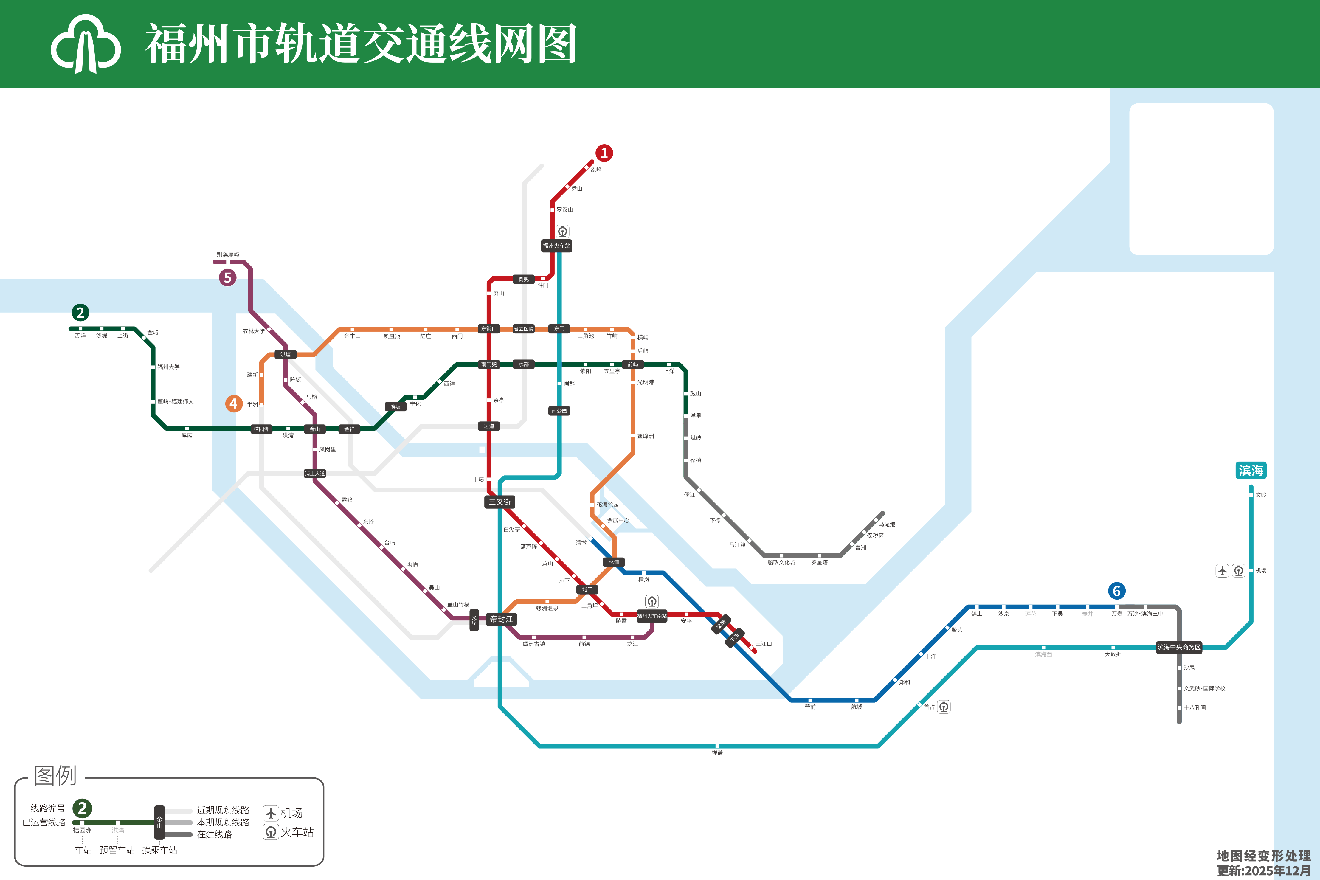
Fuzhou subway map

Large detailed map of the Fuzhou metro in China

Fuzhou metro

Photo credits (CC BY-SA 4.0) : SCJiang

A large map in Chinese of the Fuzhou subway in China. The map shows all lines in color, station names in Chinese, and connections between stations.

The history of the Fuzhou Metro began in 2016 with the opening of its first rapid transit line. As the capital of Fujian Province continued to grow, the network expanded with new lines connecting residential districts, business centers, railway stations, and the airport. Today, the Fuzhou Metro is an essential part of the city's public transport system and continues to develop to meet increasing travel demand.


Average ticket price: ¥ 2 - 7

Creation date: 2016

Total length of the network: 205 km

Dalian


Changchun


Changsha


Chengdu


Chongqing


Dongguan


Foshan


Guangzhou


Hangzhou


Hong Kong


Nanjing


Shanghai


Wenzhou


Wuhan


Wuhu


Wuxi


Xiamen


Xuzhou


Zhengzhou


China Subway Map


Metro map of all cities


Homepage


Mapsubway.com is a website and mobile app that provides quick access to detailed subway maps worldwide. A complete list of cities and rankings by country are available, along with general information about each city's subway system.

List of cities | Cookies | Terms of use | Source | Contact | Lastatlas.com | mapsubway.com