MAPSUBWAY
Metro map of Xiamen
Large map of the Xiamen metro, a city in China.
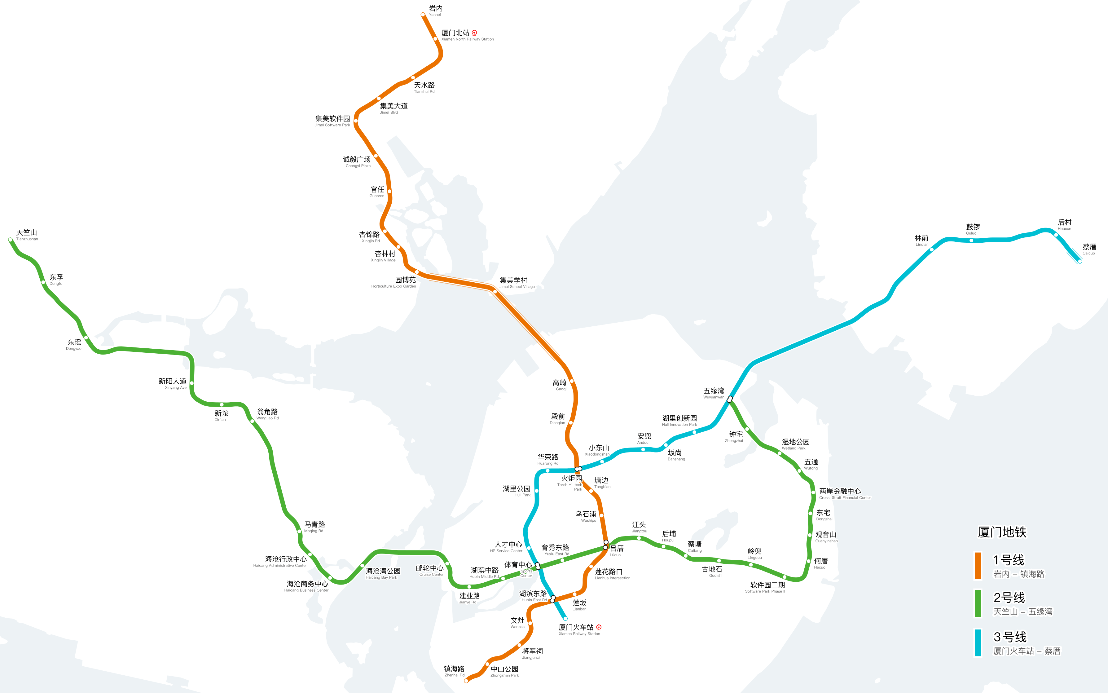
Photo credits (CC BY-SA 4.0) : Yveltal

A large, detailed map of the Xiamen metro system in China, with all metro lines in color and the names of all metro stations. The map is written in Chinese and English for easy understanding.
The Xiamen Metro is the rapid transit system serving Xiamen, a coastal city in Fujian Province, China. Construction began in 2013, and the first line, Line 1, opened on December 31, 2017, becoming the first underground railway system in Fujian Province. The initial route connected the northern districts with the city center, including a section crossing the sea through a dedicated railway bridge. Additional lines were later opened to improve connections between the island of Xiamen, mainland districts and major transport hubs. Today, the Xiamen Metro continues to expand and plays an important role in the city's public transportation network, supporting the growth of this important coastal metropolis.