MAPSUBWAY
Metro map of Wuxi
Large map of the Wuxi metro, a city in China.
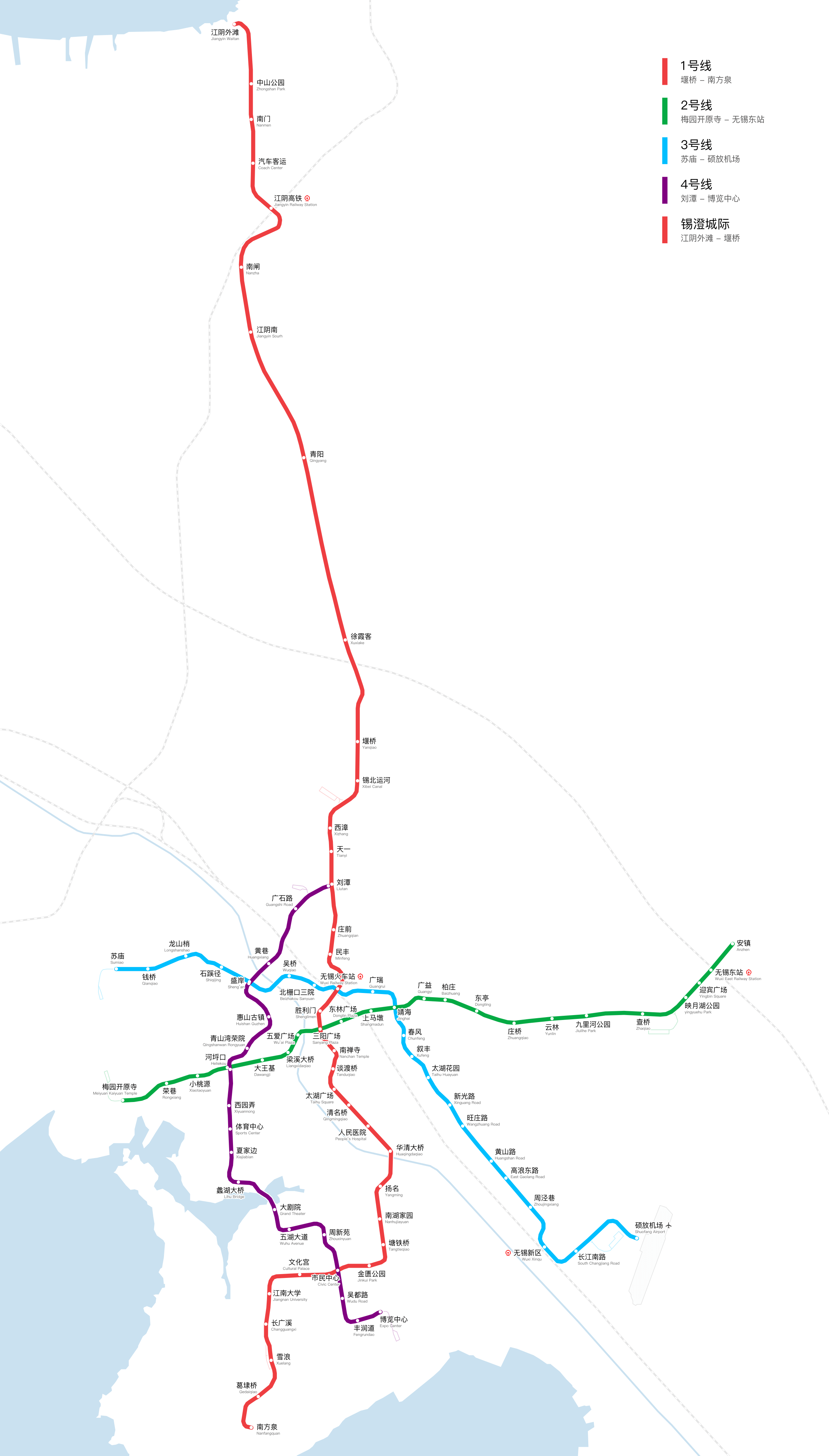
Photo credits (CC BY-SA 4.0) : Yveltal

A subway map of Wuxi, China, with colored subway lines and station names. The map is written in both Chinese and English for easy understanding.
The Wuxi Metro is the rapid transit system serving Wuxi, a major city in Jiangsu Province, China. Construction began in 2009, and the first line, Line 1, opened on July 1, 2014, connecting the northern and southern parts of the city. Line 2 followed in 2014, extending the network across important urban areas and improving connections with railway stations and residential districts. Further expansions have added new routes to support Wuxi's economic growth and urban development. Today, the Wuxi Metro provides an efficient transportation solution for the city, helping reduce traffic congestion and connecting key areas around the Taihu Lake region.