MAPSUBWAY
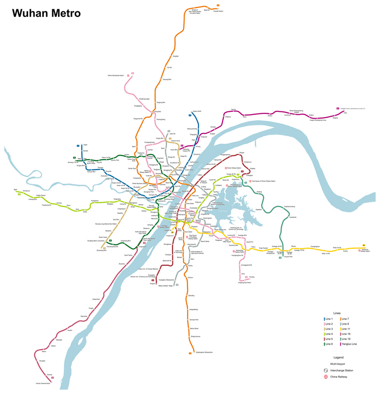
Subway map of Wuhan
Large map of Wuhan metro in China.

Photo credits (CC BY-SA 4.0) : Painjet
A large, detailed map of the Wuhan metro system in China. The map shows the city's various lines in color, along with the name of each metro station in English. The map also shows connections between metro lines, airports, and train stations.