Metro map of Hangzhou
Large map of Hangzhou metro in China
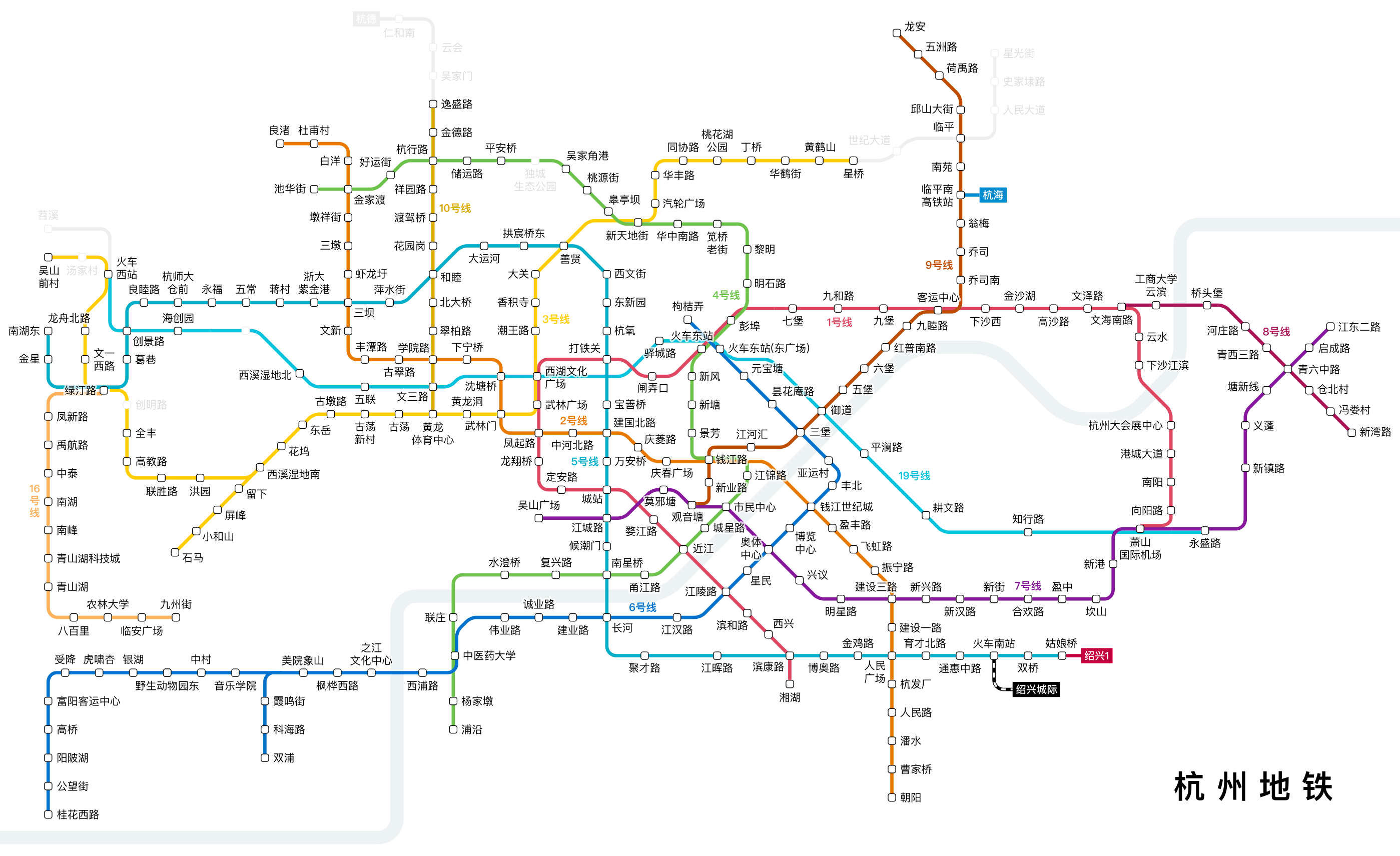
Photo credits (CC BY-SA 4.0) : 刻晴

Large, detailed map of the Hangzhou metro system, a city in China. The map shows the names of all stations and metro lines in Hangzhou.
The history of the Hangzhou Metro began in the early 21st century as the city experienced rapid economic growth and urban expansion. Construction of the first metro line started in 2007, and Line 1 opened in 2012, providing a modern rapid transit system for residents and visitors. Since then, the network has expanded at an impressive pace, with multiple new lines connecting residential districts, business centers, railway stations, and Hangzhou Xiaoshan International Airport. The metro also played an important role in improving transportation for major international events, including the 2022 Asian Games. Today, the Hangzhou Metro is one of China's fastest-growing urban rail systems, with an extensive network that continues to expand to meet the needs of the city's growing population.