MAPSUBWAY
Metro map of Wenzhou
Wenzhou metro map with both lines.
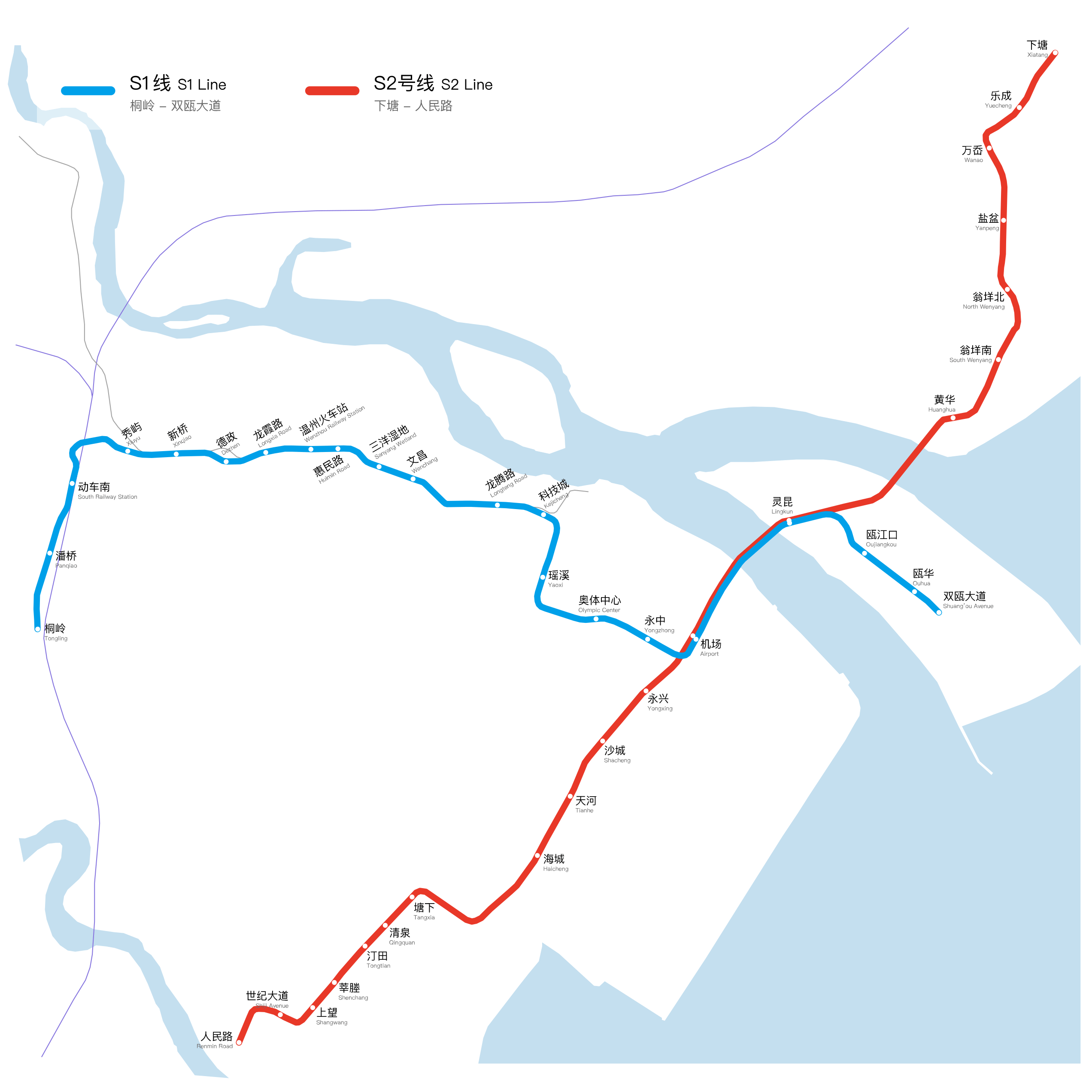
Photo credits (CC BY-SA 4.0) : Yveltal

A large map of the Wenzhou metro in China, showing the city's two metro lines. The map also shows the names of each Wenzhou metro station in Chinese and English.
The Wenzhou Metro is the rapid transit system serving Wenzhou, a coastal city in Zhejiang Province, China. Construction began in 2011 as part of the city's urban development plans. The first line, Line S1, opened on September 23, 2019, becoming the first operational metro line in Wenzhou and connecting the western and eastern parts of the city. Further expansions have extended the network to improve connections between urban districts, transportation hubs and surrounding areas. Today, the Wenzhou Metro continues to grow as an important part of the city's public transportation system, helping reduce road congestion and supporting the development of this rapidly growing region.