MAPSUBWAY
Detailed map of Changchun City metro
Changchun City Subway with lines and stations
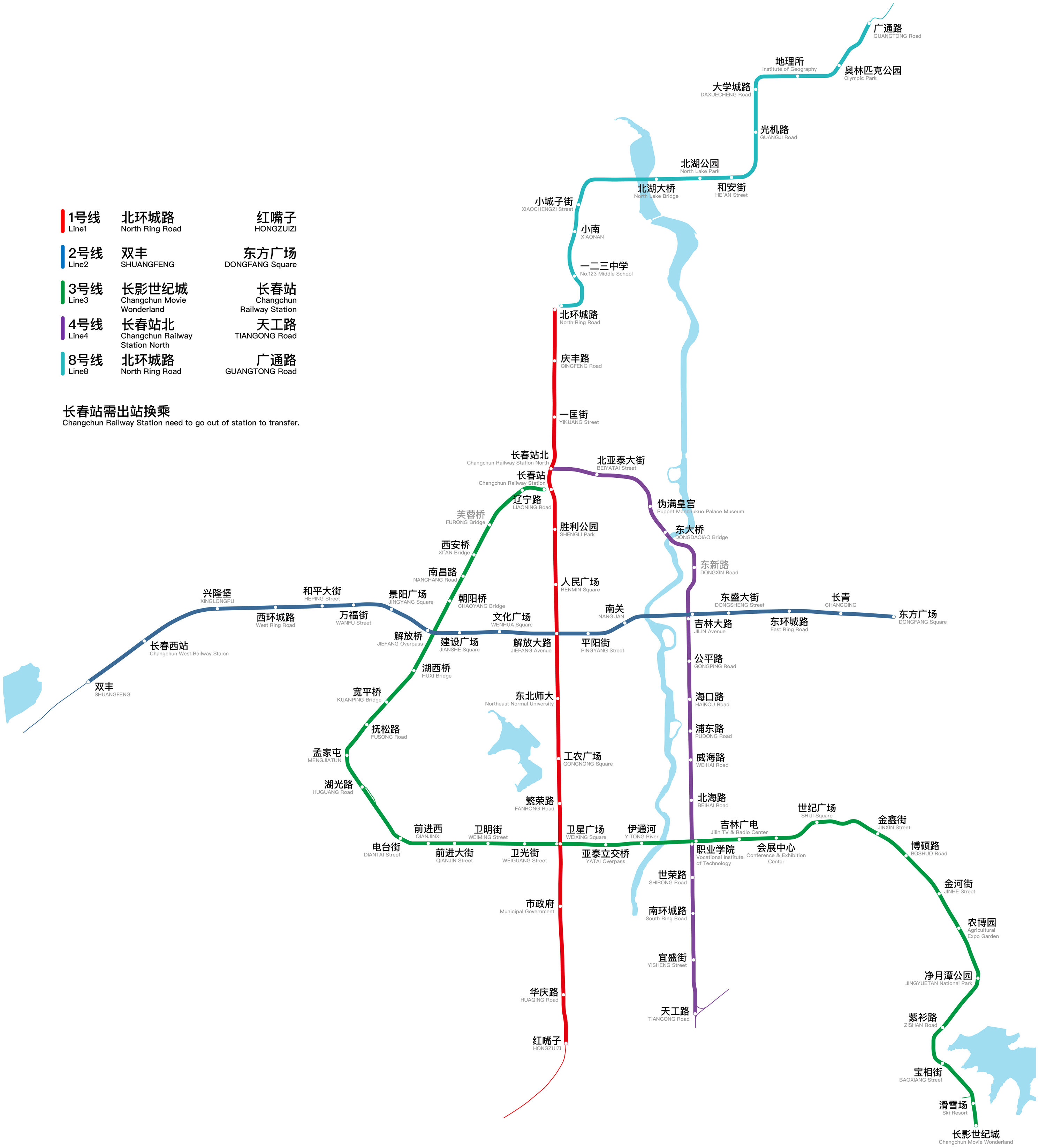
Photo credits (CC BY-SA 4.0) : Kmchang28 at Chinese Wikipedia

A large map of the Changchun metro system in China. The map details all the city's metro lines and stations. Line and station names are written in both English and Chinese.
The history of the Changchun Metro began in 2017 with the opening of its first rapid transit line, complementing the city's long-established tram network. Since then, the system has expanded quickly with several new lines serving residential districts, business areas, and major transport hubs. Designed to support the growth of Changchun, the metro has become an essential part of the city's public transportation network, providing fast and efficient travel for millions of passengers each year.