MAPSUBWAY
Foshan Metro Map
Detailed map of the Foshan metro in China
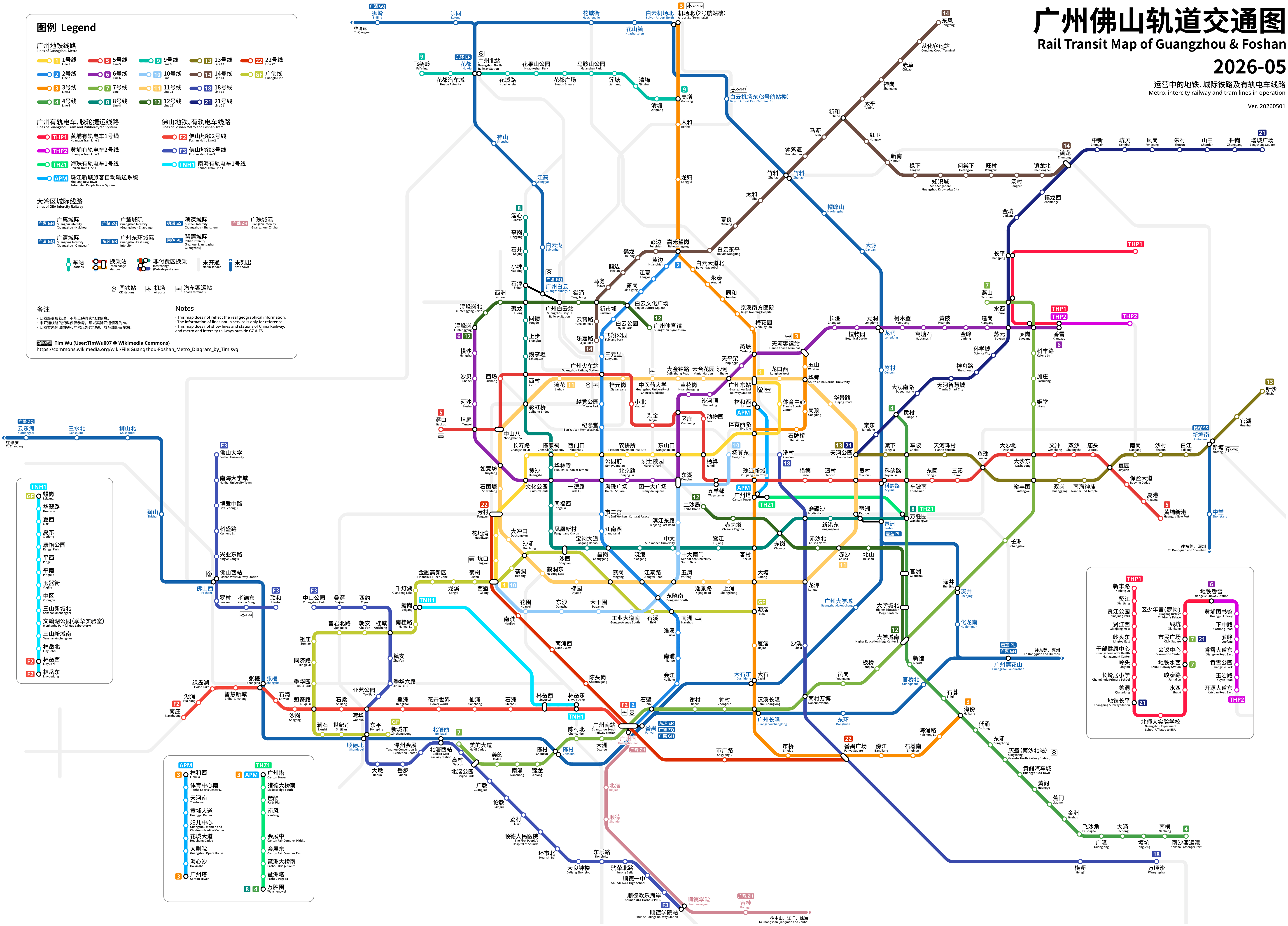
Photo credits (CC BY-SA 4.0) : Tim Wu

A large, detailed map of the Foshan metro system in China, with all metro lines in color. The map shows station names in English and Chinese, as well as connections to trains, airports, and buses.
The history of the Foshan Metro began in 2010 with the opening of Guangfo Line, the first intercity metro line in China connecting Foshan and Guangzhou. Since then, the network has expanded with additional lines serving residential areas, business districts, and major transport hubs. Today, the Foshan Metro is an important part of the Pearl River Delta's integrated public transport system and continues to grow alongside the city's rapid development.