Metro map of Nanjing
Large map of the Nanjing metro in China
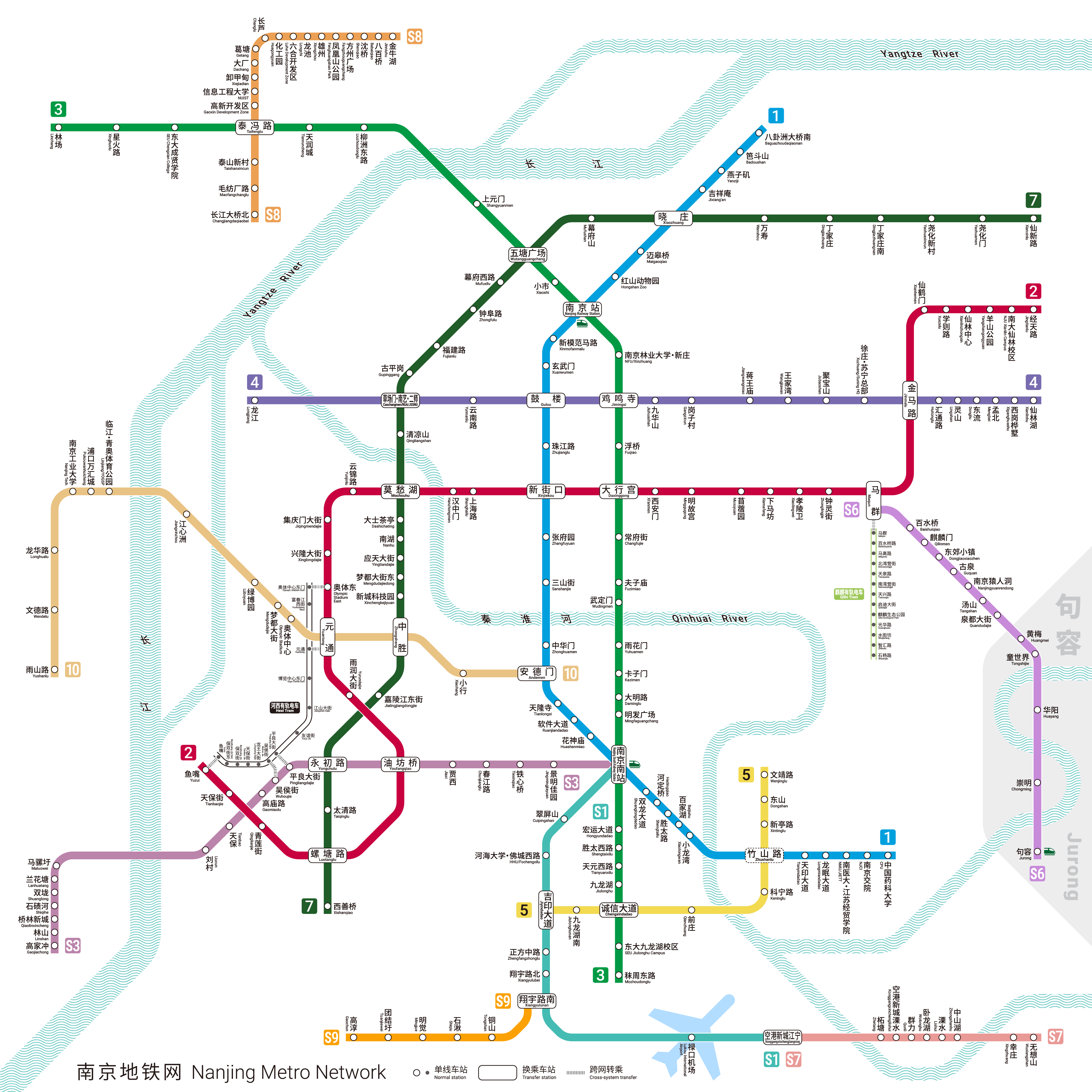
Photo credits (CC BY-SA 4.0) : Alan Fan Pei

View a large map of the Nanjing metro system in China, showing all lines and the names of all metro stations in the city. The map is written in Chinese and English.
The history of the Nanjing Metro began in the 1990s as the city planned a modern rapid transit system to support its rapid urban growth and increasing population. Construction of the first line started in 2000, and Line 1 opened in 2005, becoming one of the earliest metro systems in mainland China outside Beijing, Tianjin, and Shanghai. The network expanded rapidly with new lines connecting residential districts, commercial centers, railway stations, and Nanjing Lukou International Airport. Continuous investment has transformed the metro into a comprehensive transportation network serving millions of passengers each day. Today, the Nanjing Metro consists of multiple lines covering a large part of the metropolitan area, with further extensions planned to support the city's continued development.