MAPSUBWAY
Metro map of Xuzhou
Large detailed map of the Xuzhou metro.
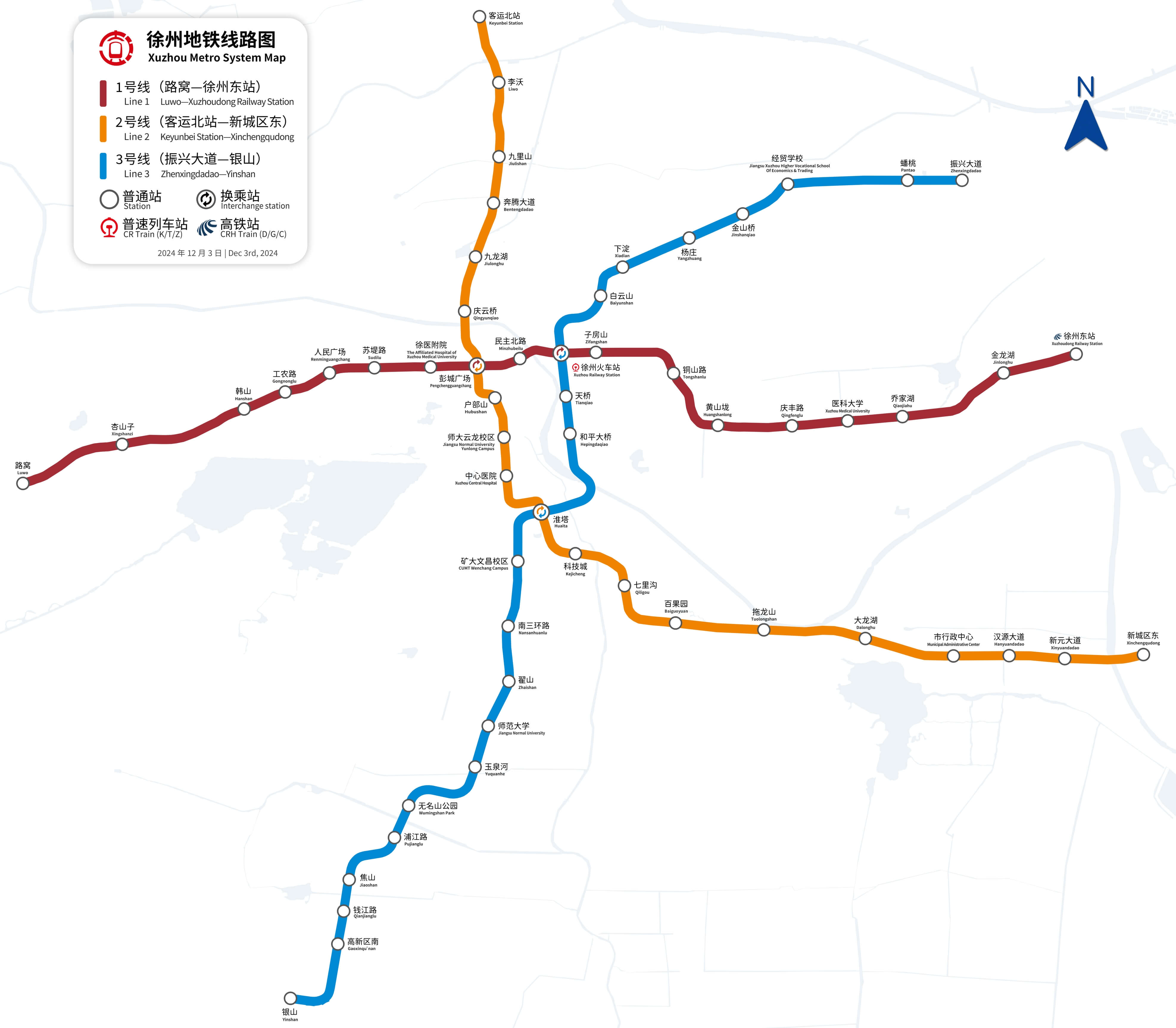
Photo credits (CC BY-SA 4.0) : Yh6987tla, Pandavid233

Large map of the Xuzhou metro in China. The map shows the names of the stations and the city's metro lines. Map in Chinese and English.
The Xuzhou Metro is the rapid transit system serving Xuzhou, a historic city in Jiangsu Province, China. Construction began in 2013, and the first section of Line 1 opened on September 28, 2019, marking the beginning of modern urban rail transport in the city. The network was developed to connect major residential areas, commercial districts and transport hubs, including Xuzhou Railway Station. Line 2 opened in 2020, followed by further extensions that expanded coverage across the metropolitan area. Today, the Xuzhou Metro continues to grow as an important part of the city's public transportation system, providing fast and convenient travel for residents and visitors.