MAPSUBWAY
Large map of the Catania metro
Detailed map of the Catania metro in Italy
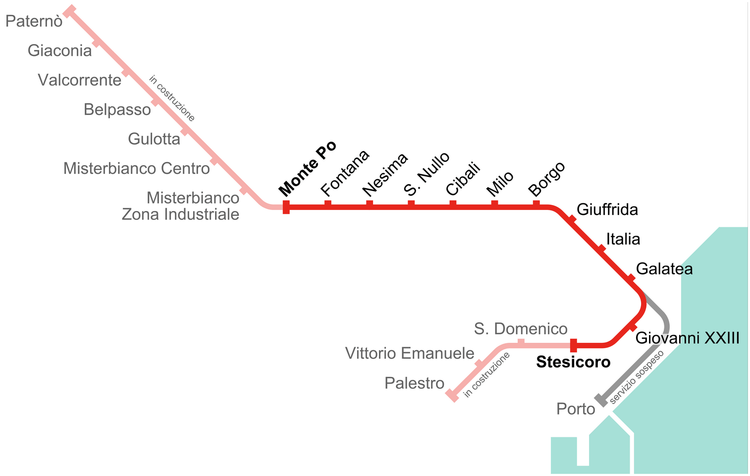
Photo credits (CC BY-SA 4.0) : Arbalete

A large map of the Catania city metro in Italy, the map shows the Italian names of all stations in operation as well as the names of stations that are under construction.
The history of the Catania Metro began in 1999 with the opening of the city's first underground line, operated by Ferrovia Circumetnea. Built partly on an existing railway corridor, the network has gradually expanded to improve public transport across the city. Several new stations have been added over the years, extending the line toward the city center and western districts. Although relatively small, the Catania Metro continues to grow and plays an increasingly important role in reducing traffic and connecting key areas of the Sicilian city.