Metro map of Milan
Detailed map of the Milan metro in Italy
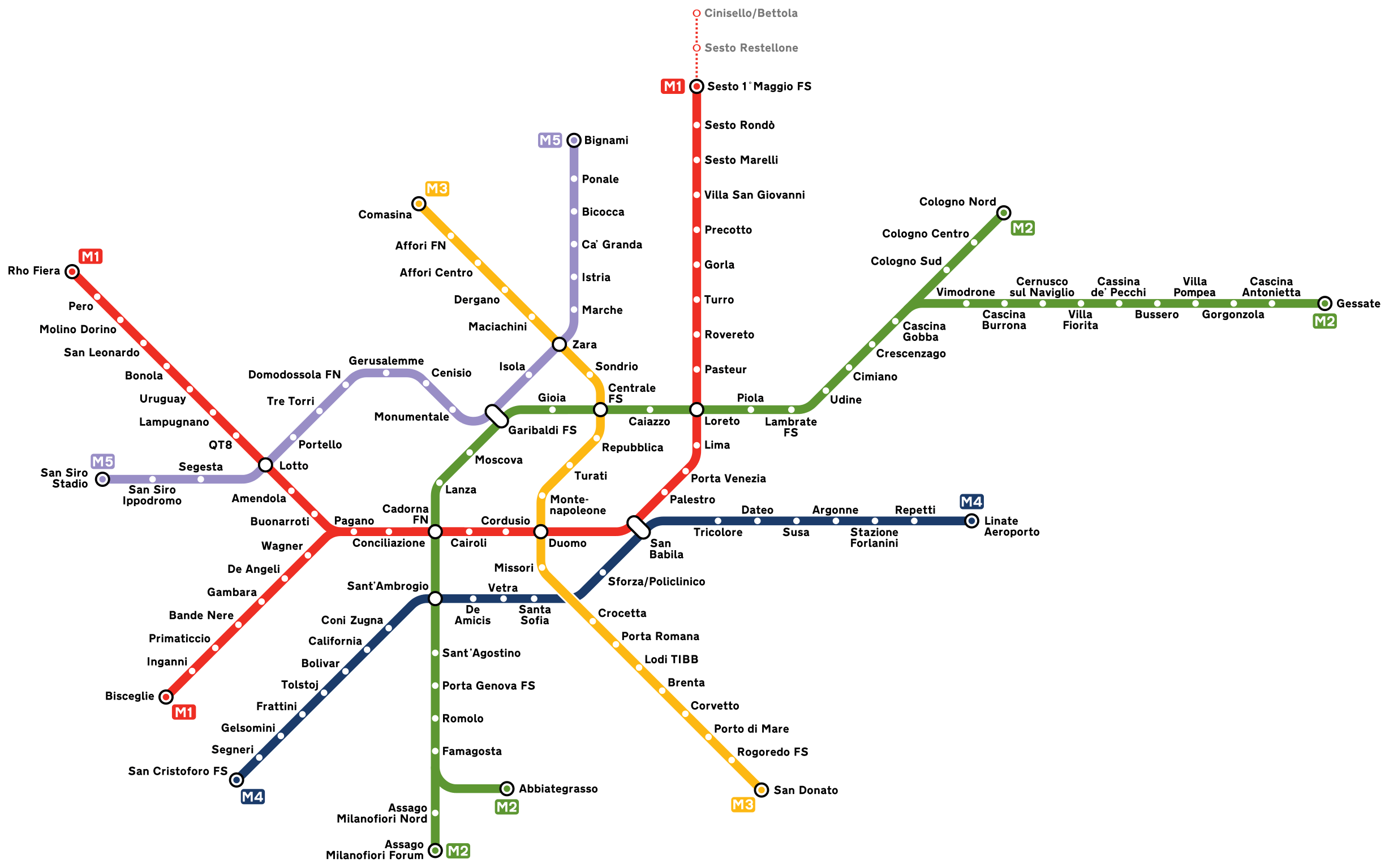
Photo credits (CC BY-SA 4.0) : Arbalete
.svg)
A large map of the Milan metro in Italy, with all metro lines in color and the name of each metro station in the city.
The history of the Milan Metro began in the 1950s as the city planned a modern rapid transit system to support its growing population and expanding economy. Construction of the first line started in 1957, and Line 1 opened in 1964, becoming Italy's first metro system. Over the following decades, additional lines were built to connect residential neighborhoods, business districts, and major railway stations across the metropolitan area. Continuous expansion and modernization have introduced new technologies, improved accessibility, and extended service to the city's suburbs. Today, the Milan Metro consists of five lines serving more than 100 stations and remains one of Europe's busiest and most efficient urban rail networks, with further extensions under development.