MAPSUBWAY
Map of the Brescia metro
Large map of the Brescia metro in Italy
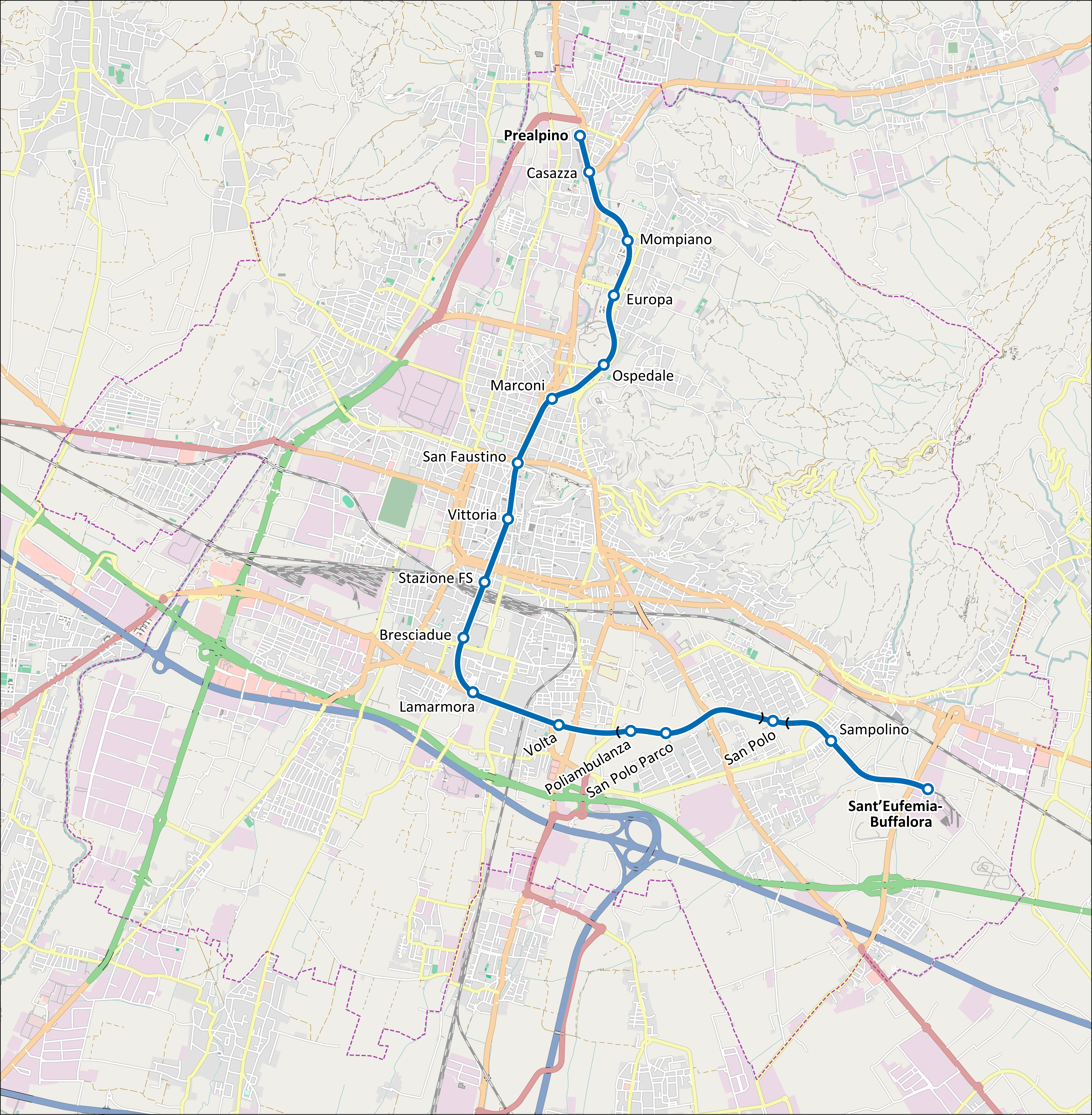
Photo credits (CC BY-SA 3.0) : Arbalete

A large map of the Brescia metro in Italy, a map with the names of all the stations on the city's metro line. The map also shows the main roads around the metro line.
The Brescia Metro opened on 2 March 2013, becoming the first fully automated metro system in Italy outside of Turin. The network was built to improve public transportation and reduce road traffic across the city. Today, it provides a fast and reliable connection between the northern and southern districts of Brescia.