MAPSUBWAY
Metro map of Rome
A large, detailed map of the Rome metro in Italy
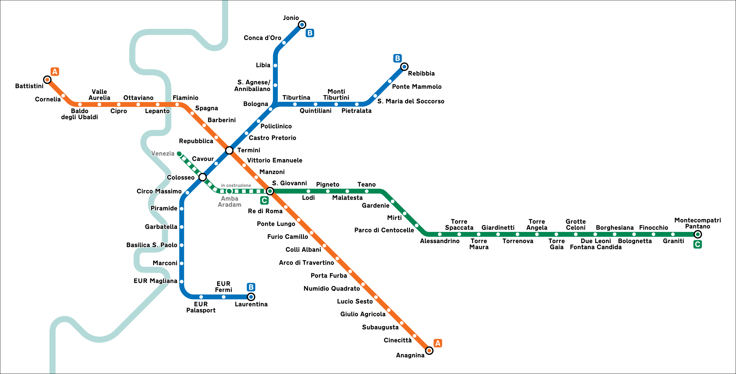
Photo credits (CC BY-SA 4.0) : Junge30
.svg)
A large metro map of Rome, the capital of Italy. A map of the Rome metro with all lines and the names of all stations in the city of Rome.
The Rome Metro opened in 1955 with the inauguration of Line B, making it the first metro system in Italy. Originally built to connect the city center with the EUR district, the network later expanded with the opening of Line A in 1980 and the modern Line C in 2014. Construction in Rome has often been slowed by the discovery of important archaeological remains beneath the city, making metro expansion particularly challenging. Today, the Rome Metro serves millions of passengers each year and provides fast connections to many of the Italian capital's historic landmarks, residential neighborhoods, and transportation hubs.