MAPSUBWAY
Detailed map of the Chennai metro
Large map of the Chennai metro in India with lots of practical information
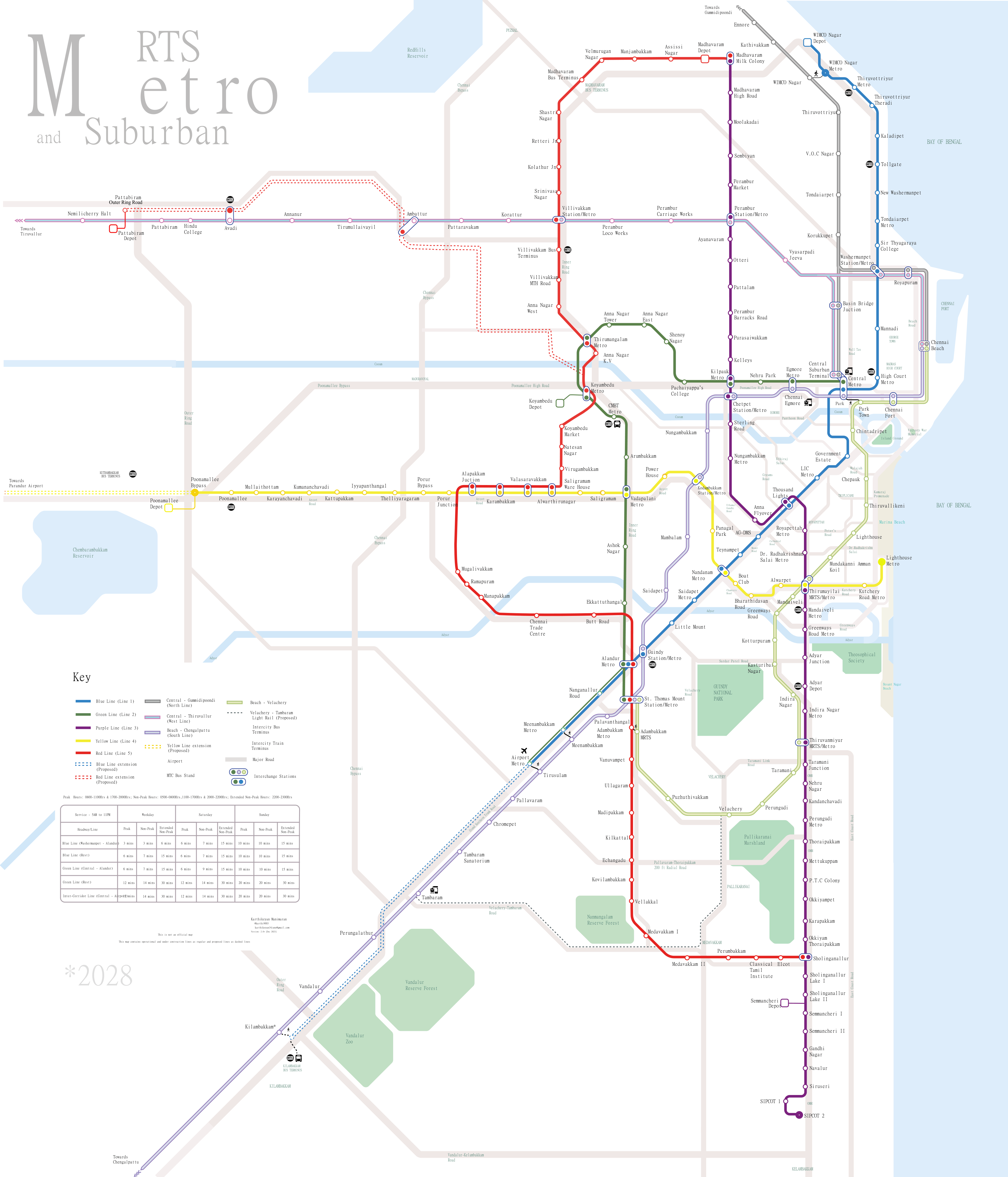
Photo credits (CC BY-SA 4.0) : TravelLover05

A large map of the Chennai metro in India with lots of practical information for travelers. It shows the city's metro lines with station names, train frequencies, and connections to railway stations and the airport.
The history of the Chennai Metro began in 2015 with the opening of the city's first modern rapid transit line. Built to reduce traffic congestion and improve urban mobility, the network has expanded steadily with new stations and extensions connecting residential areas, business districts, the airport, and major railway stations. Today, the Chennai Metro is one of India's fastest-growing metro systems and plays a key role in the city's public transport network.