Agra metro map
Large detailed map of the Agra metro in India
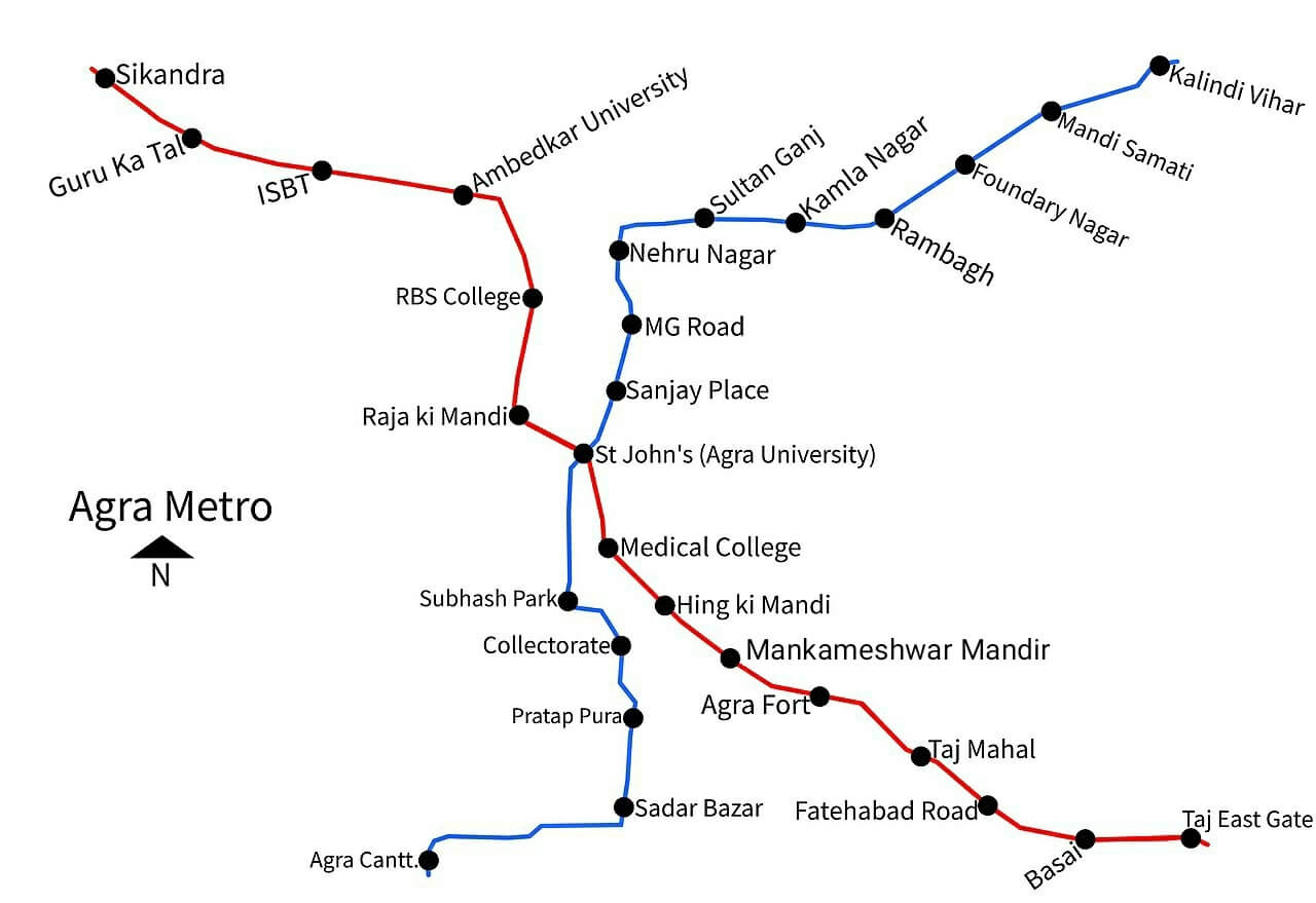
Photo credits (CC BY-SA 4.0) : Yellow alligator

A large map showing the two metro lines in the city of Agra, India, and the names of all the metro stations on both lines in the city.
The Agra Metro is a rapid transit system designed to improve public transportation in Agra, one of India's most visited tourist destinations and home to the iconic Taj Mahal. The project was approved by the Government of India in 2019, with construction beginning later that year. The first section of the Priority Corridor officially opened on 6 March 2024, marking the arrival of metro services in the city. Once completed, the network will consist of two lines covering approximately 29.4 kilometres and serving 27 stations. The system is designed to connect major residential areas, railway stations, tourist attractions, and commercial districts while reducing traffic congestion and air pollution. As the network expands, the Agra Metro is expected to become an essential part of the city's sustainable urban transport system.