MAPSUBWAY
Metro map of Yekaterinburg
Large detailed map of the Yekaterinburg metro.
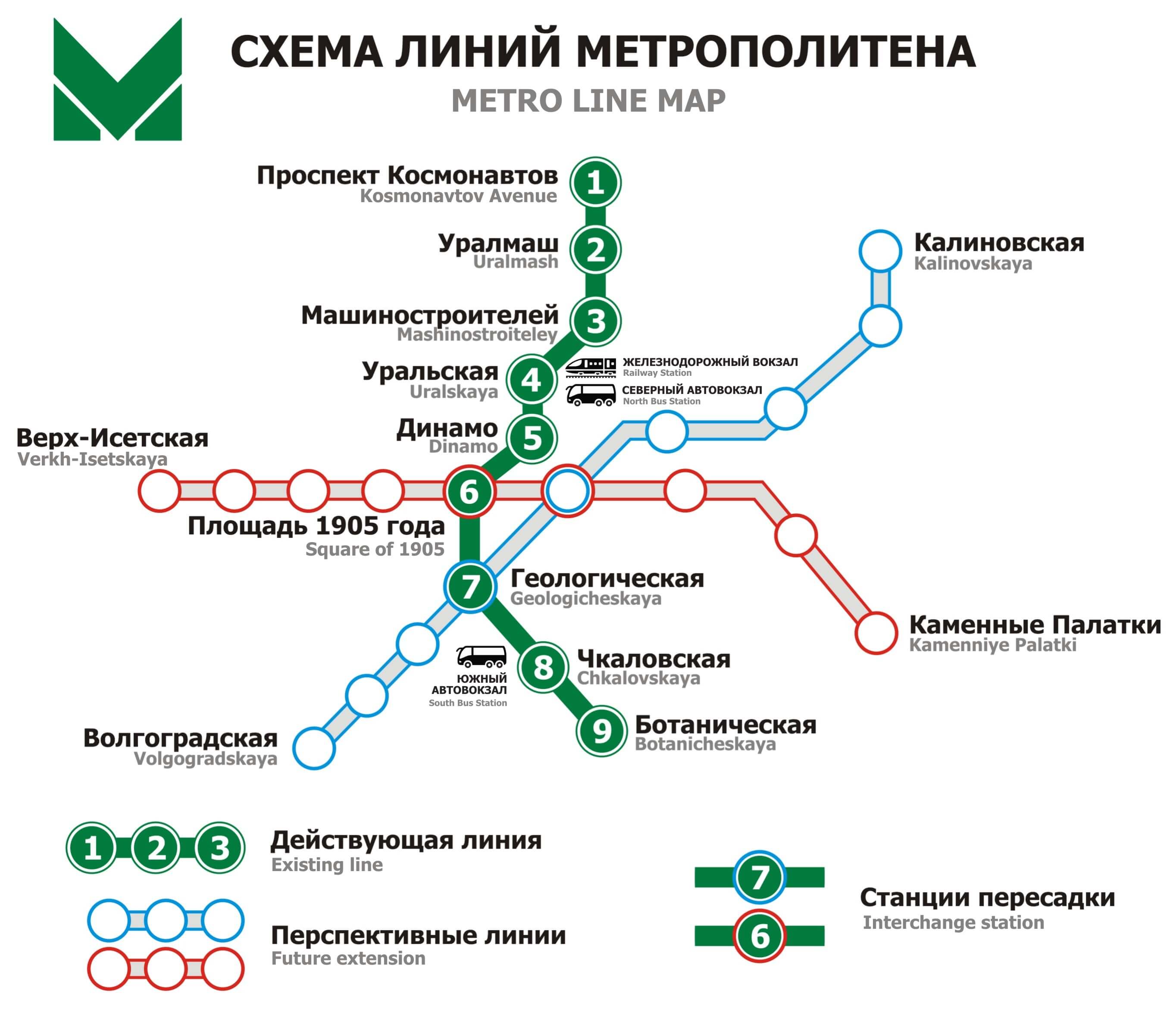
Photo credits : Metro-ektb.ru
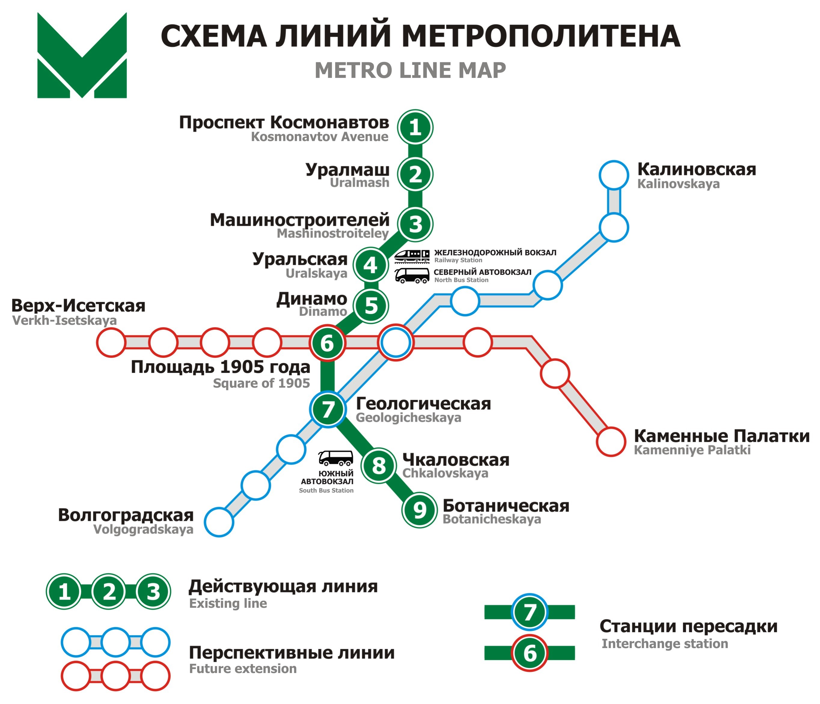
Yekaterinburg Metro Map in Russia. A large, detailed map of the metro with all stations and metro lines in the city. The map is written in Russian and English.
The Yekaterinburg Metro is the rapid transit system serving Yekaterinburg, one of the largest cities in Russia and the capital of Sverdlovsk Oblast. Construction began in 1980, and the first and only line opened on April 26, 1991, shortly before the dissolution of the Soviet Union. The initial route connected the northern and southern parts of the city through the central districts, with nine stations in its first phase. Although several expansion projects have been planned, the network has remained limited to a single line. Today, the Yekaterinburg Metro continues to provide an important transport link, serving thousands of passengers daily across the Ural region's main industrial center.