MAPSUBWAY
Metro map of Saint Petersburg
Detailed map of the Saint Petersburg metro in Russia
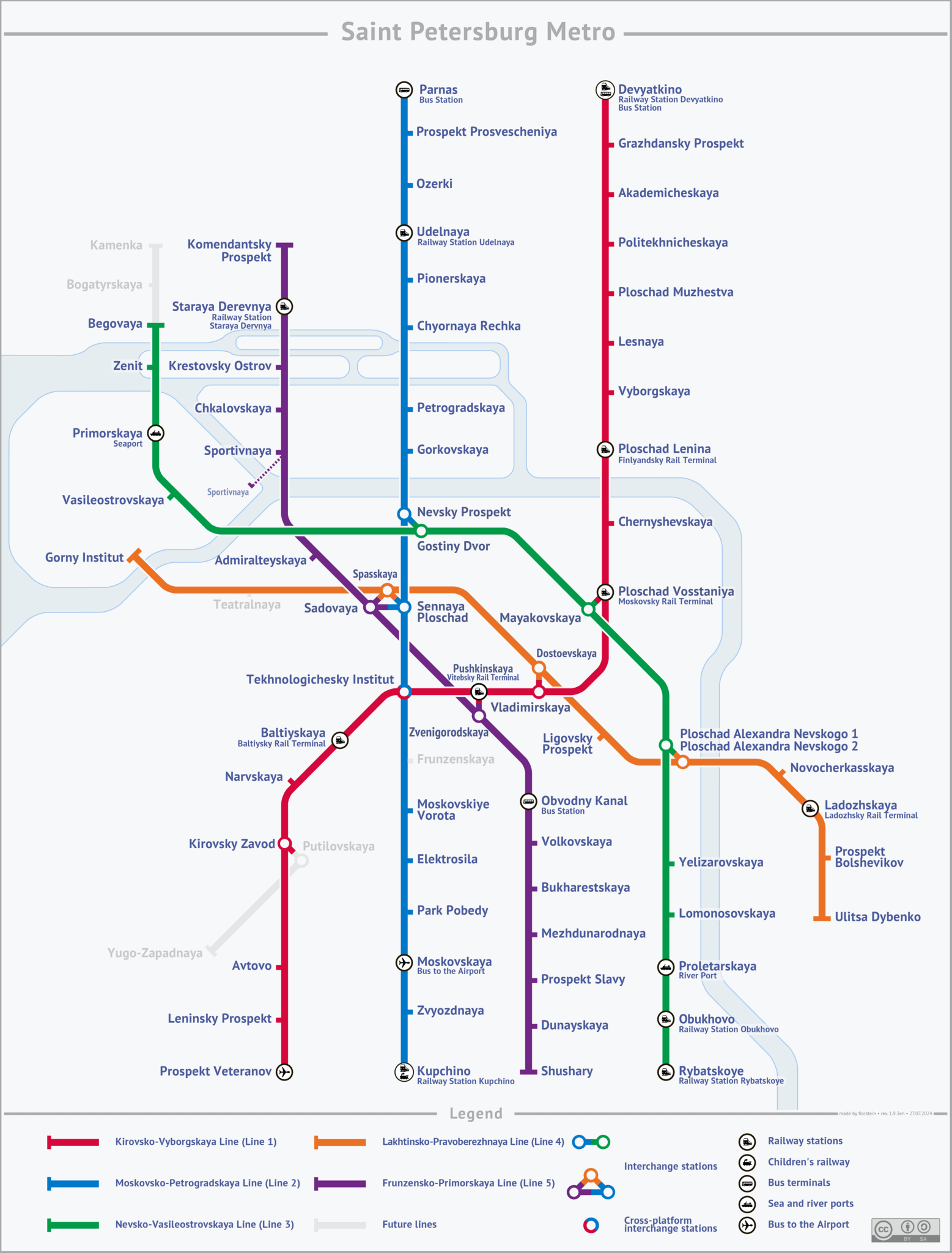
Photo credits (CC BY-SA 3.0) : Florstein

A large map of the Saint Petersburg metro in Russia. A detailed map of all metro lines with the names of the Saint Petersburg metro stations.
The Saint Petersburg Metro opened in 1955 and is one of the deepest metro systems in the world due to the city's geological conditions. Renowned for its impressive architecture, many stations feature marble, mosaics, sculptures, and grand decorative halls inspired by the Soviet tradition of building "underground palaces." Over the decades, the network has expanded to serve much of the city and its suburbs, becoming an essential part of daily transportation. Today, the Saint Petersburg Metro is known for its efficiency, elegant stations, and its important role in connecting one of Russia's largest and most historic cities.