Metro map of Helsinki
Large metro map of Helsinki, Finland
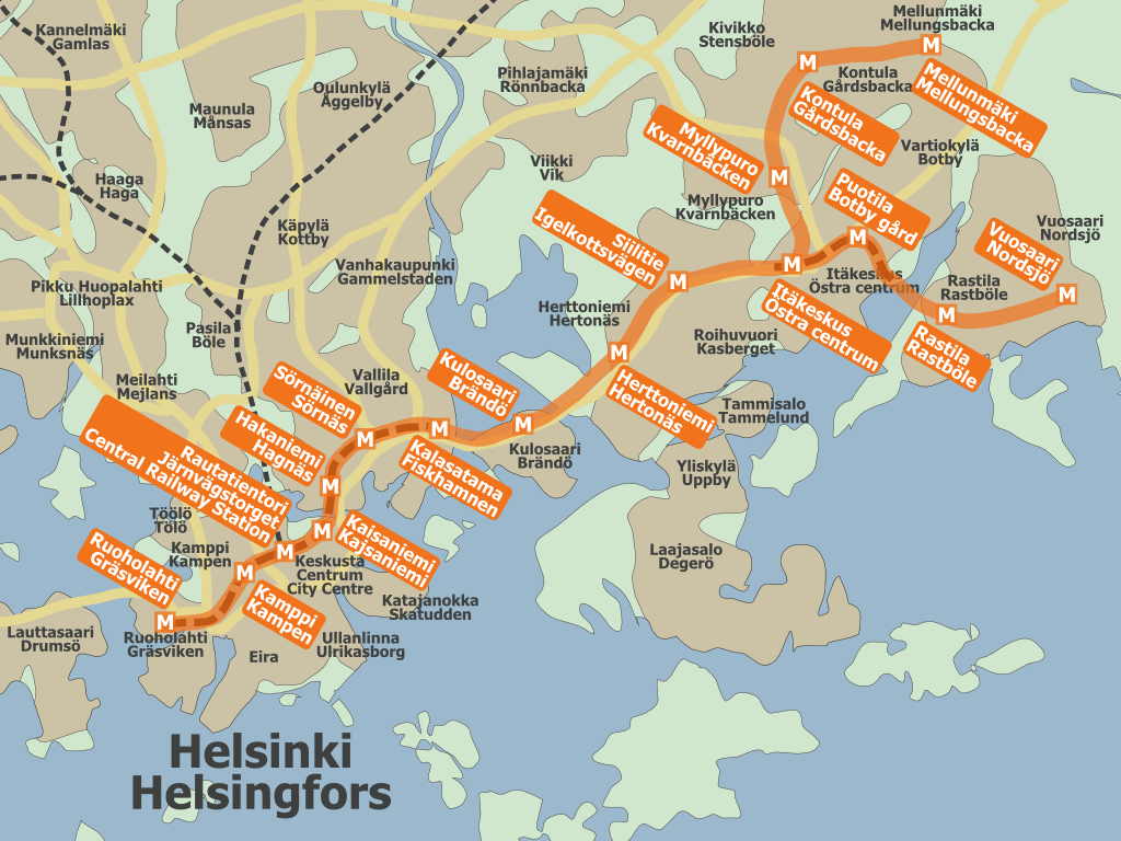
Photo credits (CC BY-SA 1.0) : Jyri Lehtinen aka. Oghmoir

A detailed map of the Helsinki metro in Finland. Large map of the Helsinki metro in Finland with station names and metro lines.
The history of the Helsinki Metro began in the 1960s when plans were developed to improve transportation across Finland's growing capital region. After years of construction and testing, the first section opened to passengers in 1982, becoming the world's northernmost metro system. Originally serving eastern Helsinki, the network gradually expanded with new stations and extensions to accommodate urban development. A major milestone was reached in 2017 with the opening of the West Metro extension, bringing the system into the neighboring city of Espoo. Today, the Helsinki Metro consists of two lines sharing a central route and serves as a vital part of the region's integrated public transport network, with further extensions planned for the future.