MAPSUBWAY
Map of the Fukuoka subway
Detailed map of the Fukuoka subway in Japan


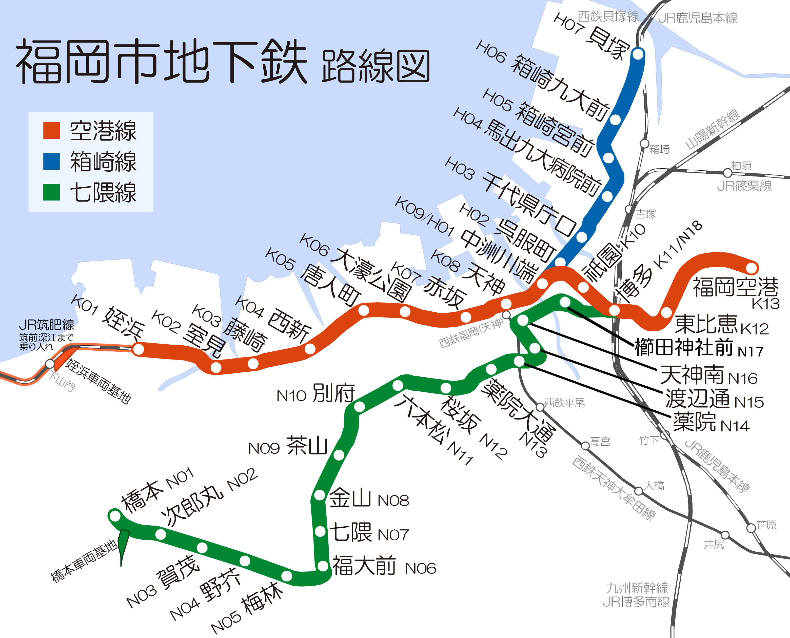
Photo credits (CC BY-SA 4.0) : ガラスパゴス

Large, detailed map of the Fukuoka subway system in Japan. The map shows the city's three subway lines with their names in Japanese and station numbers, as well as the railway lines and stations.
The history of the Fukuoka Subway began in 1981 with the opening of its first line. Built to improve transportation in one of Japan's largest cities, the network has expanded to connect the city center, Hakata Station, Fukuoka Airport, and suburban areas. Today, the Fukuoka Subway consists of three lines and plays a vital role in the city's efficient public transport system, serving millions of passengers each year.
Subway maps of other cities in the world