MAPSUBWAY
Sapporo subway map in Japan
Detailed map of the Sapporo subway with lines and stations
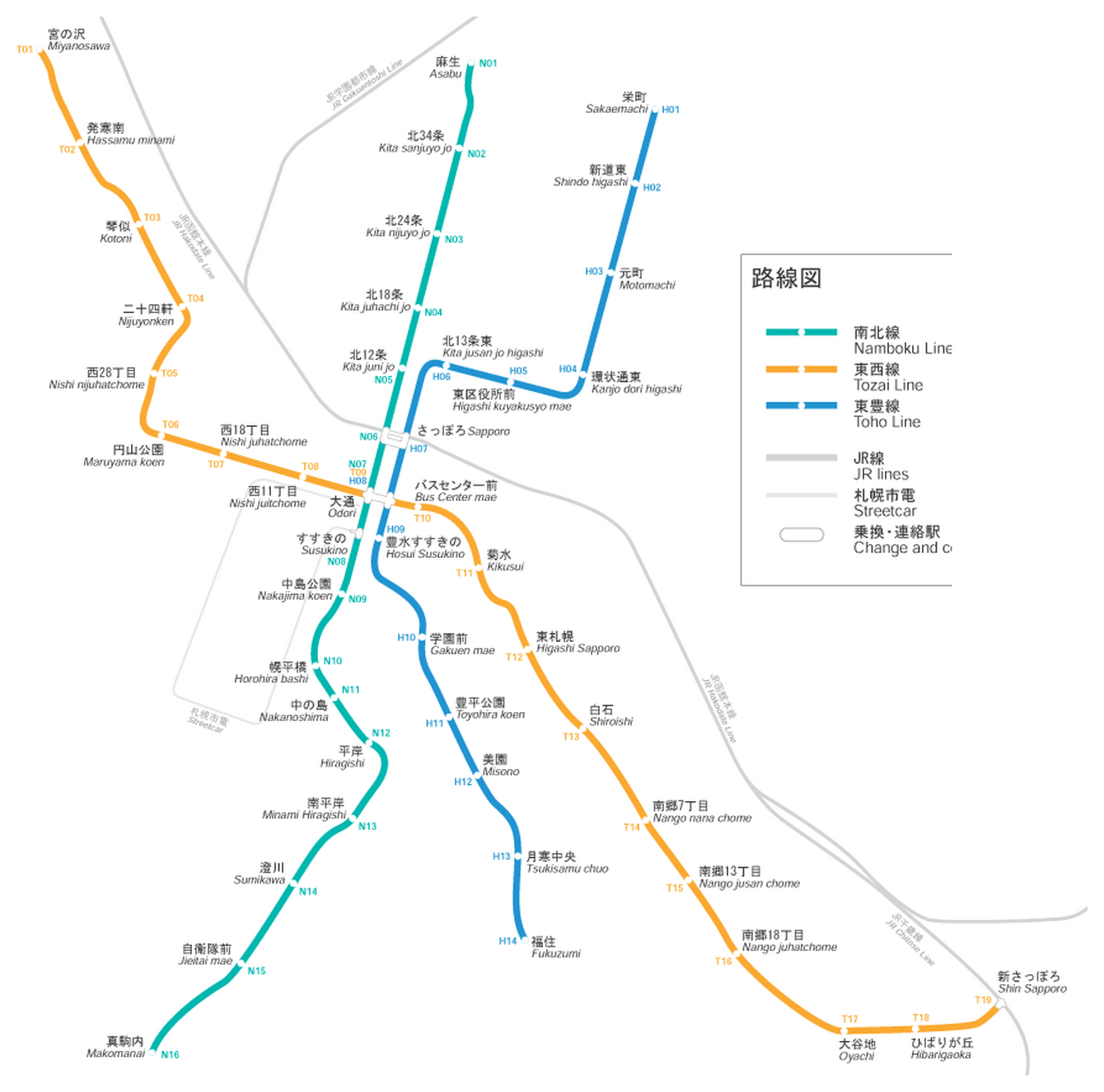
Photo credits (CC BY-SA 3.0) : Angaurits

A large map of the Sapporo subway system in Japan, with station names in Japanese and English. The map shows all the city's subway lines and stations, as well as connections between lines.
The Sapporo Municipal Subway opened in 1971, becoming the fourth metro system in Japan. It was built in preparation for the 1972 Winter Olympics, providing a modern transportation network for athletes and visitors. The system gradually expanded with the addition of new lines serving residential districts, commercial areas, and major attractions across the city. Sapporo's subway is notable for its rubber-tired trains, which offer a quieter ride and perform well during the city's harsh winter conditions. Today, it remains an essential part of public transportation in Hokkaido's largest city.