Belo Horizonte Metro Map
Large detailed map of the Belo Horizonte metro in Brazil
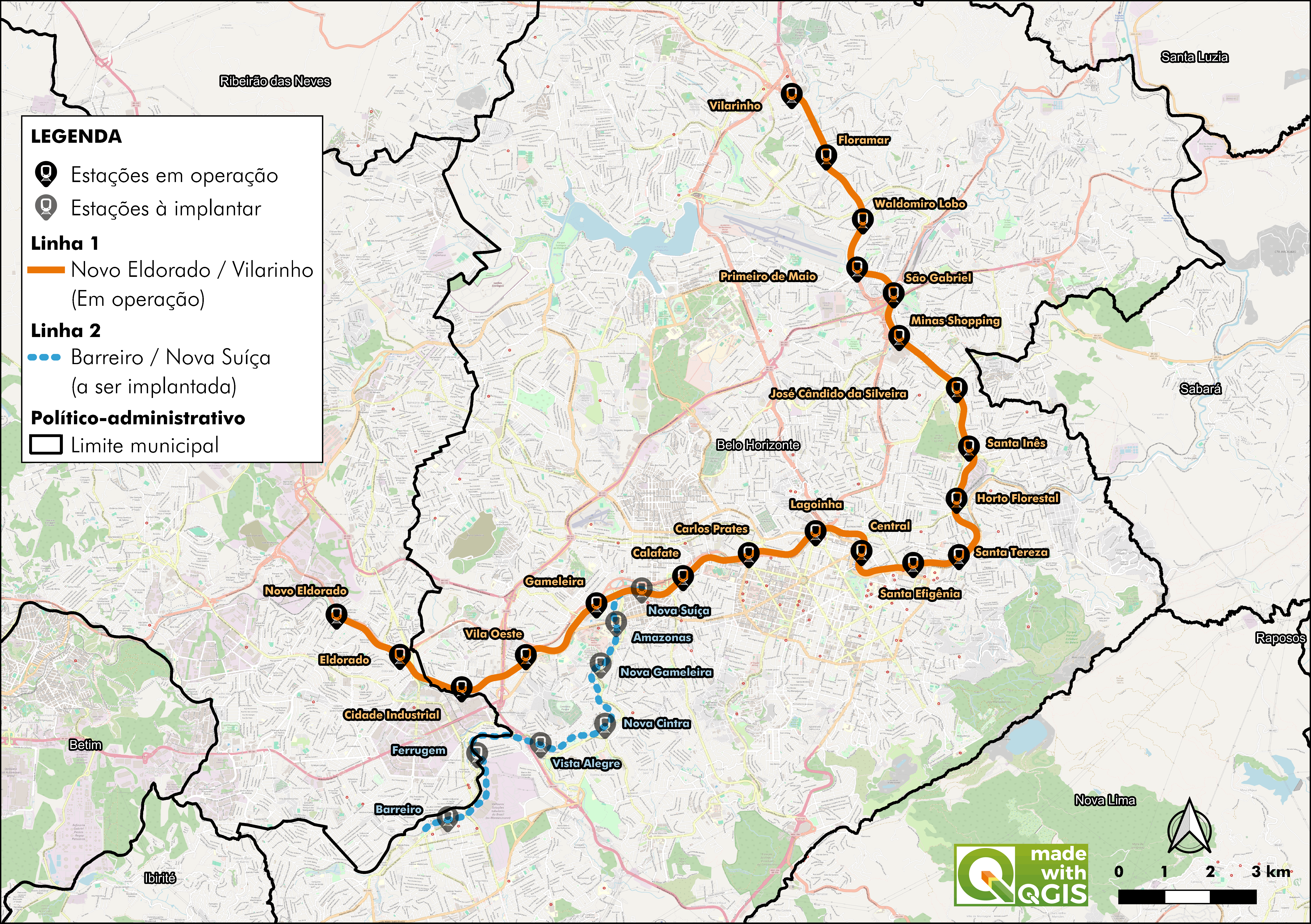
Photo credits (CC BY 4.0) : Ladislau Fernandes

A large map of the Belo Horionte metro line in Brazil. The map shows the names of all the city's stations and the surrounding streets. It also indicates the proposed extension for Line 2.
The Belo Horizonte Metro is the rapid transit system serving Belo Horizonte, the capital of the Brazilian state of Minas Gerais. Plans for the network were developed during the 1970s to improve mobility in one of Brazil's fastest-growing cities. Construction began in 1981, and the first section officially opened on 1 August 1986 between Eldorado and Central. The line was gradually extended over the following years, reaching Vilarinho in 2002. Today, the Belo Horizonte Metro operates a single line stretching approximately 28 kilometres and serving 19 stations. A long-planned second line is currently under construction and will significantly expand the network in the coming years. The metro provides an efficient connection between the city centre, residential districts, and key transport hubs, carrying thousands of passengers every day across the metropolitan area.