Baltimore subway map
Large map of the Baltimore subway in the United States
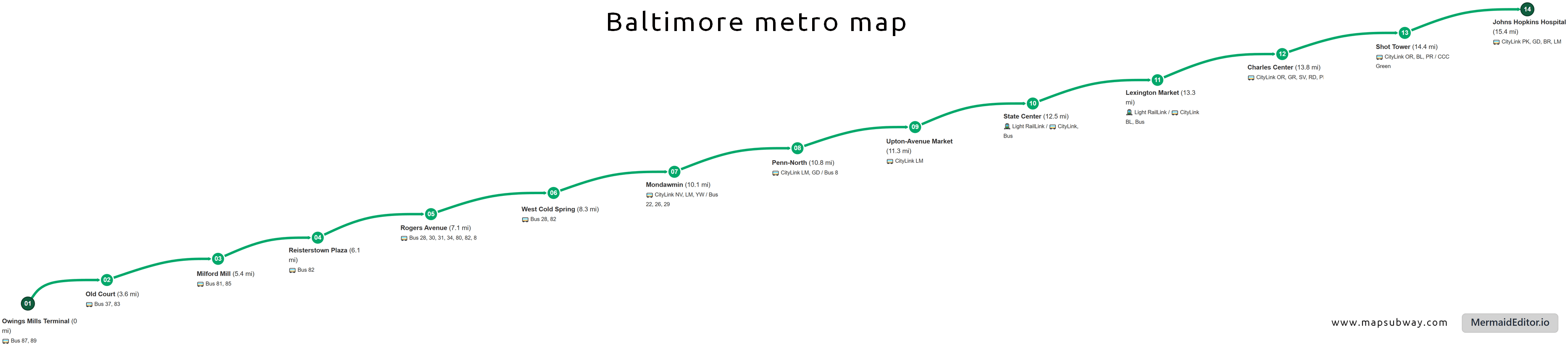
Photo credits (Public domain) : Mapsubway.com

Large map of the Baltimore subway in the United States with the names of the subway line stations, the distance between stations and connections with bus numbers.
The Baltimore Metro SubwayLink is the only heavy rail rapid transit system serving Baltimore, Maryland. Planning for the network began during the 1960s as part of efforts to improve public transportation and reduce road congestion across the metropolitan area. Construction started in 1972, and the first section officially opened on 21 November 1983 between Charles Center and Reisterstown Plaza. The line was later extended north to Owings Mills in 1987 and south to Johns Hopkins Hospital in 1995, creating its current route. Today, the Metro SubwayLink operates a single 24.8-kilometre line serving 14 stations. The system connects downtown Baltimore with residential neighbourhoods, medical centres, and major employment hubs, forming an important part of the region's public transport network alongside the Light RailLink and local bus services.