Metro map of Ankara
A large map of the Ankara metro in Türkiye
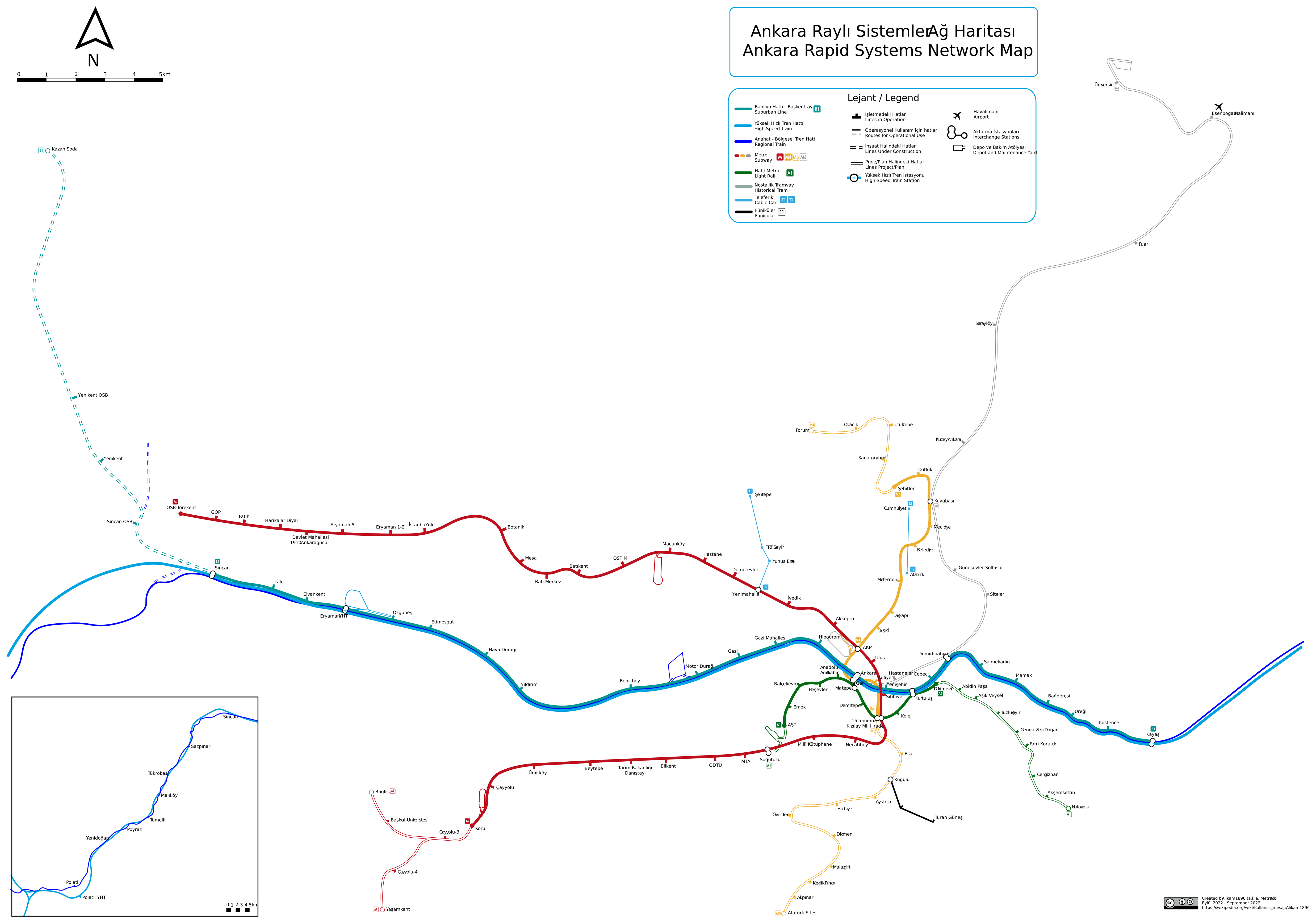
Photo credits (CC BY-SA 4.0) : Jelican9

A large, detailed metro map of Ankara, the capital of Turkey. Ankara metro map with all lines and stations in the city.
The Ankara Metro is the rapid transit system serving Türkiye's capital city. Plans for the network were developed during the 1980s to address the city's rapid population growth and increasing traffic congestion. Construction of the first line began in 1992, and the metro officially opened on 28 December 1997 between Kızılay and Batıkent. Over the following decades, the system expanded with several new lines and extensions, connecting residential districts, business centres, universities, and major transport hubs across the city. Today, the Ankara Metro consists of four metro lines, complemented by the Ankaray light metro line, creating a network of more than 64 kilometres and over 50 stations. Together, these systems form the backbone of public transportation in Ankara, providing millions of passengers each year with a fast and reliable alternative to road travel.