Adana Metro Map
Map of the Adana metro in Türkiye with stations
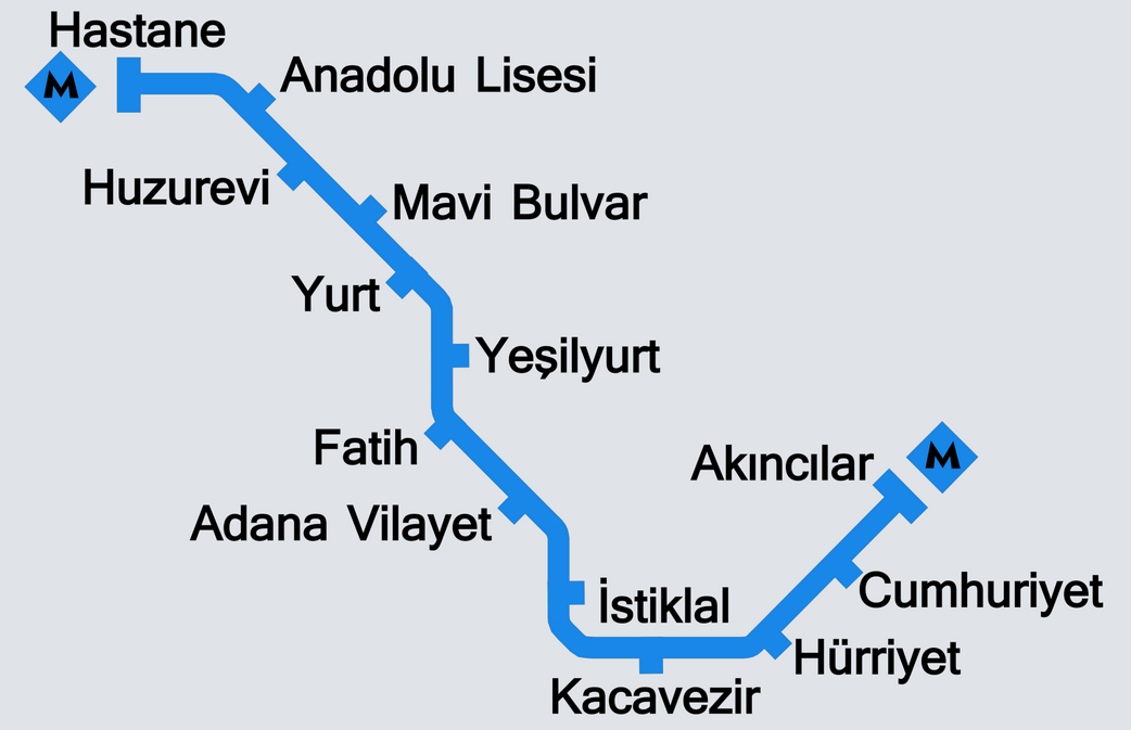
Photo credits (CC BY-SA 3.0) : R1410

A large map of the Adana city metro in Türkiye with the names of all the city's metro stations.
The Adana Metro is the only rapid transit line serving the southern Turkish city of Adana. Plans for the system were first proposed in 1988 as the city's population and traffic congestion continued to grow. Construction officially began in January 1999, but financial difficulties forced the project to stop in 2002 before work resumed in 2008 with additional government funding. A first section of the line opened on 18 March 2009 between Hastane and Vilayet stations, operating temporarily before closing again to complete the remaining infrastructure. The entire 13.9-kilometre line, serving 13 stations, officially entered service on 14 May 2010. Today, the Adana Metro provides an important north-south transport corridor across the city, linking residential districts, hospitals, universities and the city centre, while helping to reduce road congestion in one of Türkiye's largest metropolitan areas.