Ahmedabad metro map
Large map of the Ahmedabad metro in India
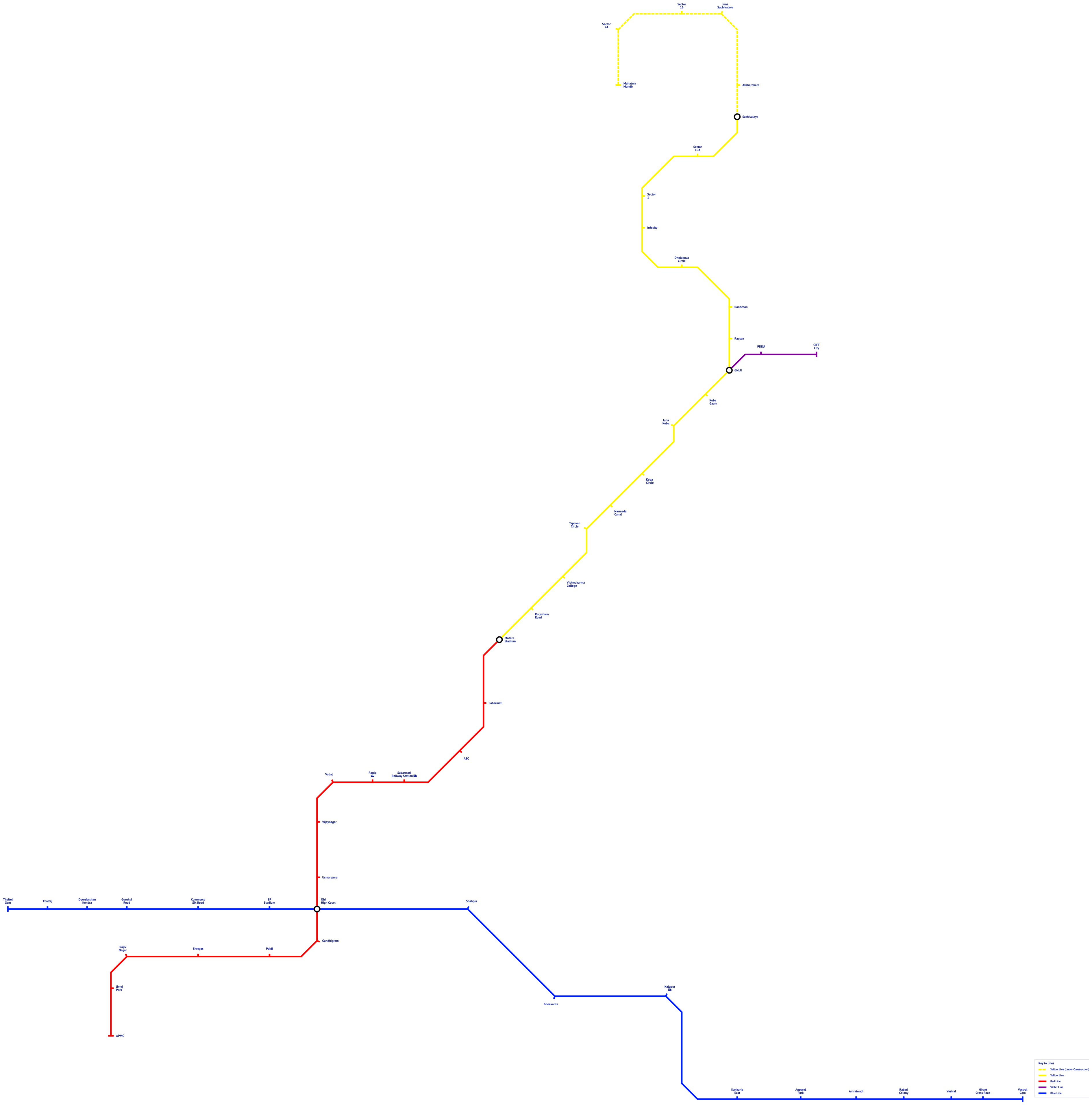
Photo credits (CC BY-SA 4.0) : Dilip kabiraj

The Ahmedabad metro map in India, with all metro lines in color and the name of each metro station in the city. The map also indicates the names of metro stations that are connected to a railway station.
The Ahmedabad Metro is a modern rapid transit system serving Ahmedabad and the neighbouring city of Gandhinagar in the western Indian state of Gujarat. The project was approved in 2014 to provide a fast and sustainable alternative to the region's growing road traffic. Construction began in 2015, and the first 6.5-kilometre section of the East-West Line opened on 4 March 2019. A major expansion followed on 30 September 2022, extending both the East-West and North-South lines and significantly increasing the network's coverage. Today, the Ahmedabad Metro consists of two lines stretching over 40 kilometres and serving dozens of stations. The system connects key residential districts, business centres, educational institutions, and transport hubs, playing an increasingly important role in the development of one of India's fastest-growing metropolitan areas.