MAPSUBWAY
Detailed map of the Warsaw metro
Large map of the Warsaw metro with both metro lines.
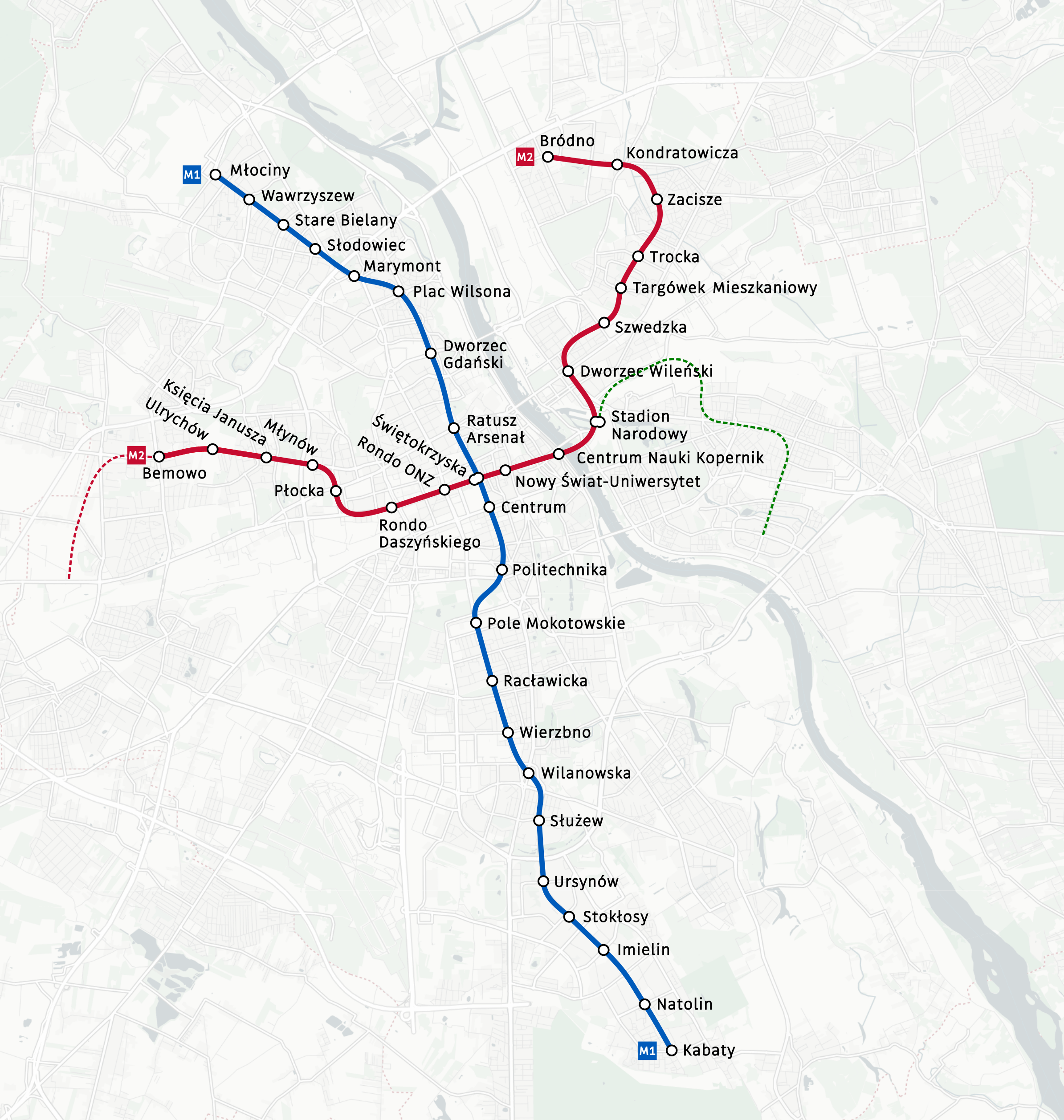
Photo credits (CC BY-SA 4.0) : Obywatel A.N.

A detailed map of the Warsaw metro, the capital of Poland. The scaled map details the city's two metro lines and the name of each metro station.
The Warsaw Metro is the underground rapid transit system serving the capital of Poland. Construction began in 1983, but economic and political difficulties delayed the project for many years. The first section of Line 1 opened on April 7, 1995, connecting Kabaty and Politechnika stations. The network was gradually extended northwards, reaching the city center and northern districts. A second line, running east-west across Warsaw, opened in 2015 and was later expanded with additional stations. Today, the Warsaw Metro is an essential part of the city's public transport system, providing fast and efficient connections between residential areas, business districts and major landmarks.