MAPSUBWAY
Metro map of Taipei
Detailed map of Taipei metro in Taiwan
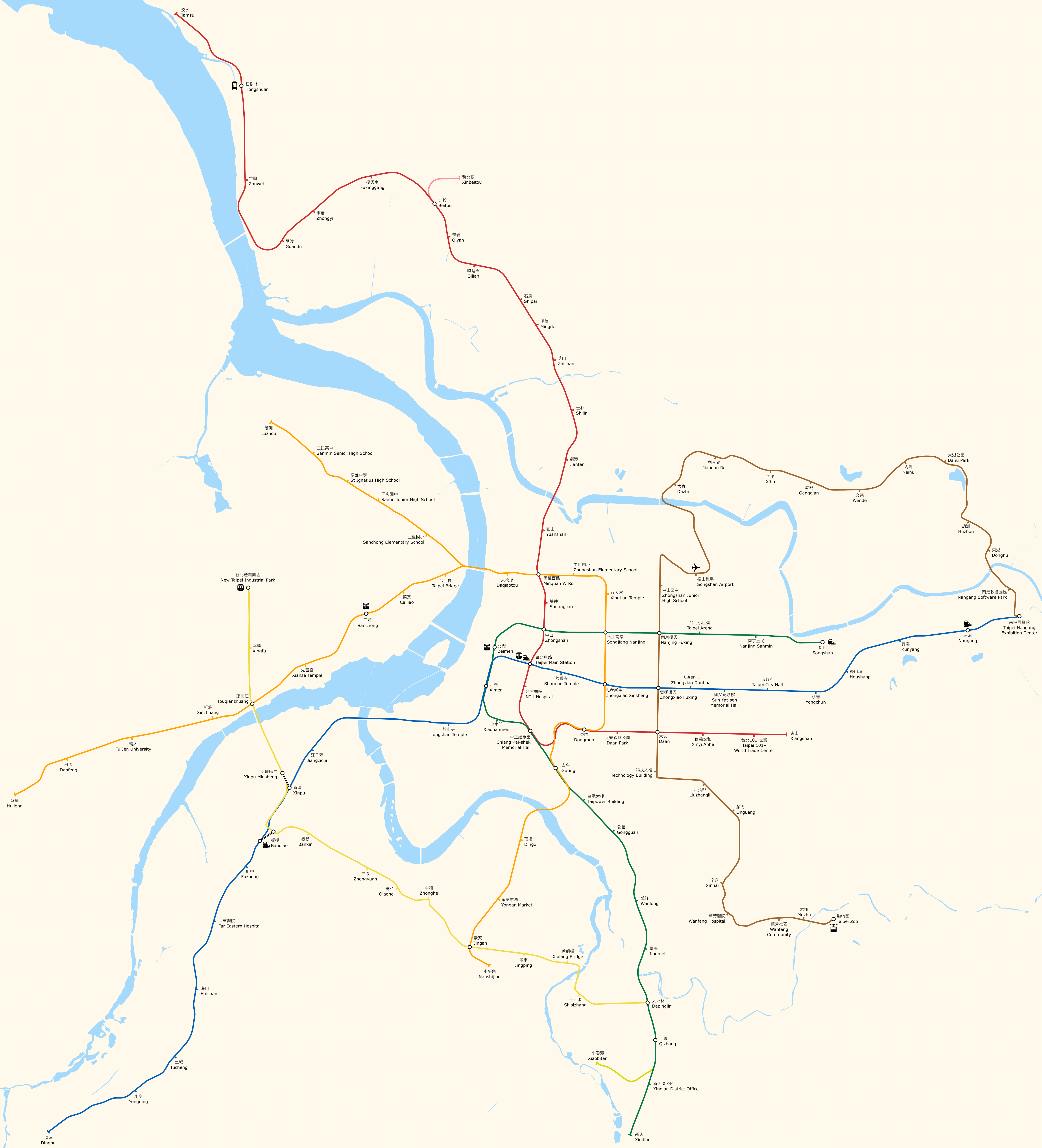
Photo credits (CC BY-SA 4.0) : Ythlev

A large map of the Taipei Metro in Taiwan, with all lines and station names written in Chinese and English. The map is to geographic scale.
The Taipei Metro opened on 28 March 1996 and quickly became one of Asia's most efficient rapid transit systems. The network was developed to reduce traffic congestion and provide fast, reliable transportation across Taipei and New Taipei City. Today, it serves millions of passengers every day and is widely recognized for its cleanliness, punctuality and modern infrastructure.