MAPSUBWAY
Metro map of Riyadh
Detailed map of the Riyadh metro in Saudi Arabia
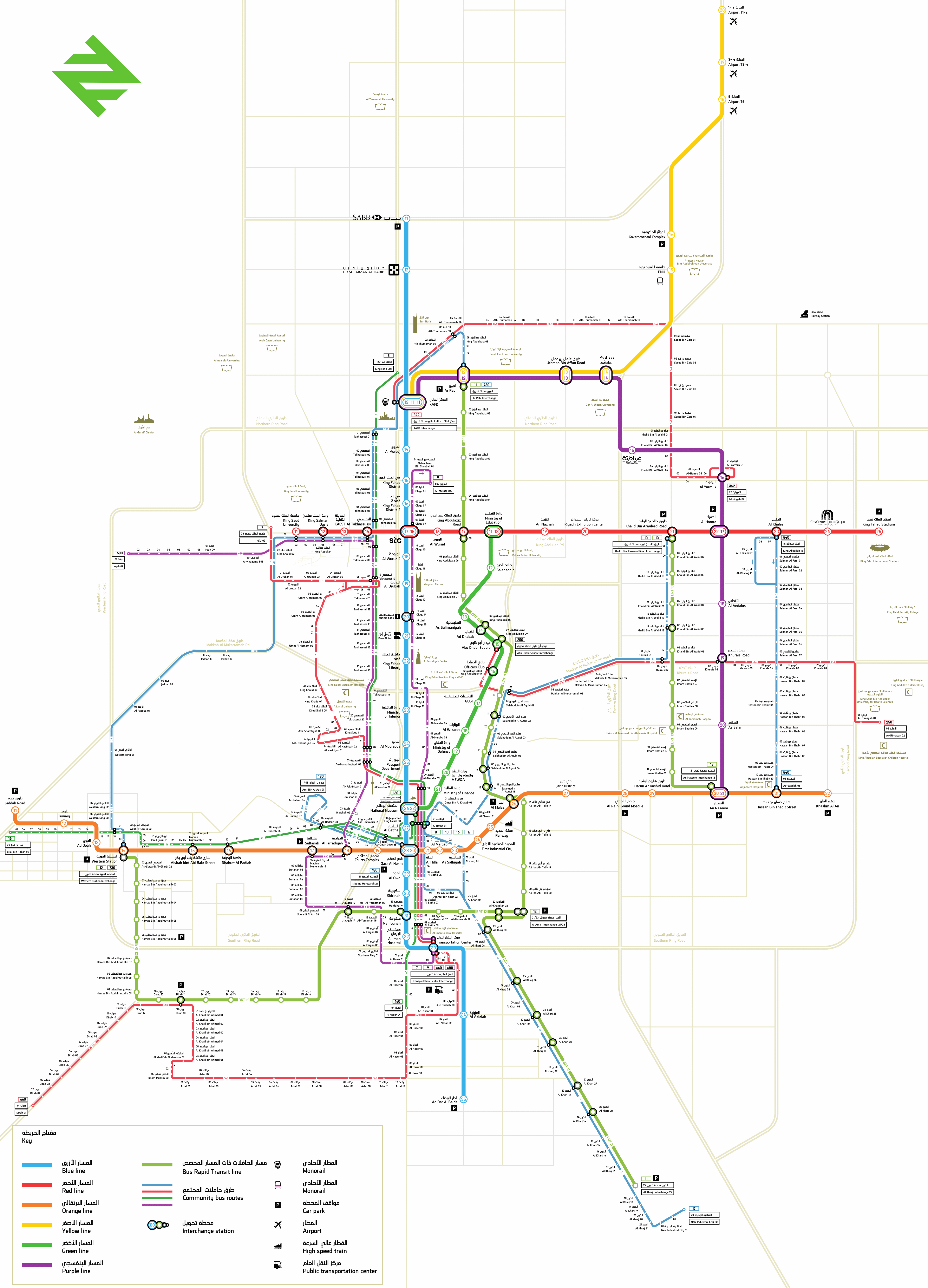
Photo credits (CC BY-SA 4.0) : Salman Mazini

A large, detailed map of the Riyadh metro in Saudi Arabia. A very large map of the Riyadh metro, written in Arabic and English, shows all the lines and stations in the city.
The Riyadh Metro is one of the world's largest newly built rapid transit systems. Construction began in 2014 as part of a major initiative to improve mobility and reduce road congestion in the rapidly growing capital of Saudi Arabia. The network consists of six fully automated lines serving key districts, business centers, universities, and King Khalid International Airport. Passenger services began in 2024 with the gradual opening of the lines. Featuring modern stations and driverless trains, the Riyadh Metro has quickly become a central element of the city's public transportation network and its long-term urban development strategy.