Metro map of Montreal
Detailed map of the Montreal metro in Canada
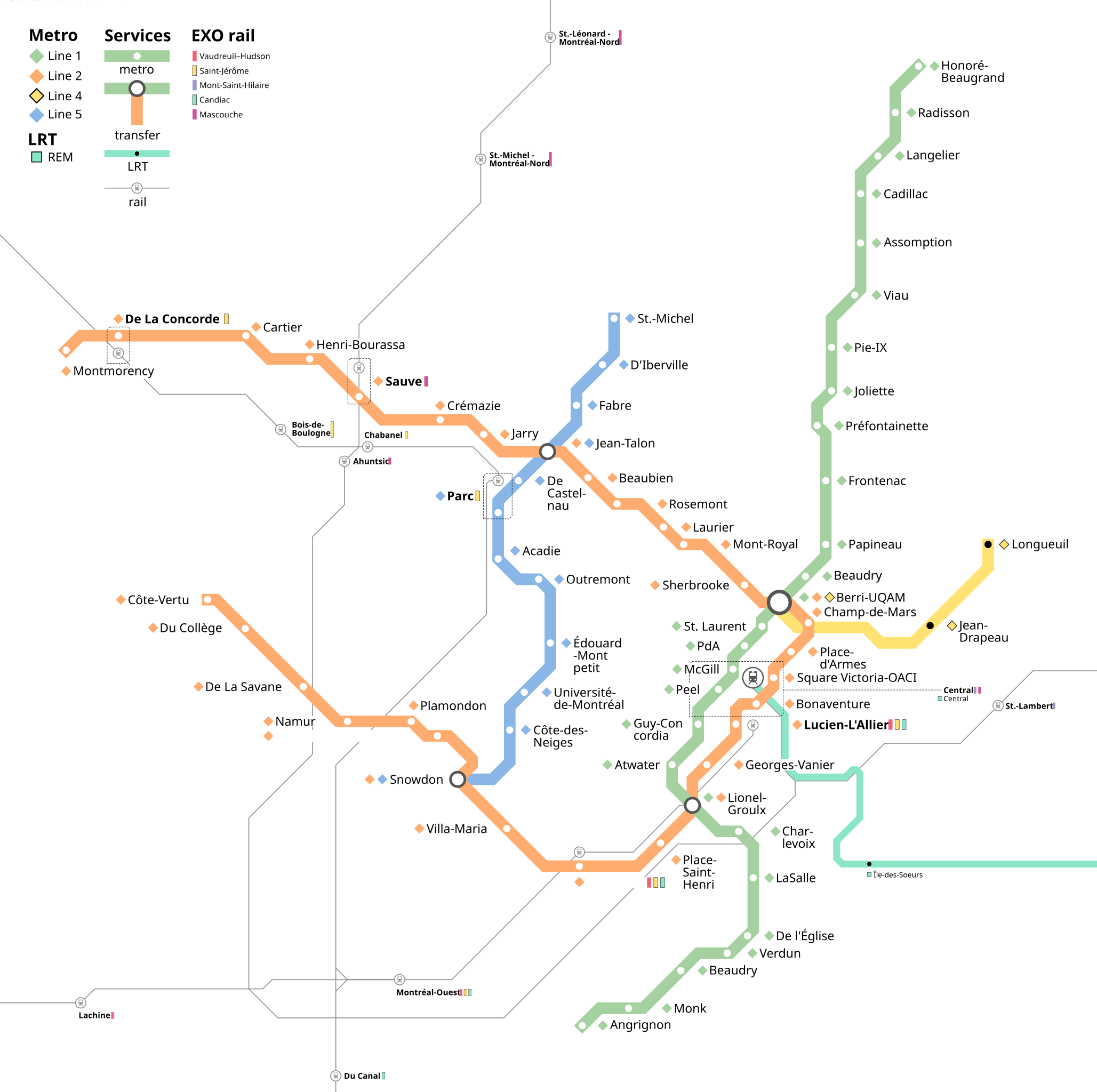
Photo credits (public domain) : MapperGuy87

A large, detailed map of the Montreal metro system in Canada. Montreal metro map with lines and station names.
The history of the Montreal Metro began in the early 1960s as the city prepared for Expo 67 and sought to modernize its public transportation system. Construction started in 1962, and the first three lines opened in 1966, making Montreal the second Canadian city to operate a metro after Toronto's subway. Inspired by the Paris Metro, the system was built entirely underground and uses rubber-tired trains for quieter and smoother operation. The network expanded over the following decades with new stations and extensions serving growing residential areas and key destinations. Today, the Montreal Metro consists of four lines and remains an essential part of daily transportation, with ongoing projects aimed at improving connections across the metropolitan region.