Metro map of Lille
Detailed map of the Lille metro in France
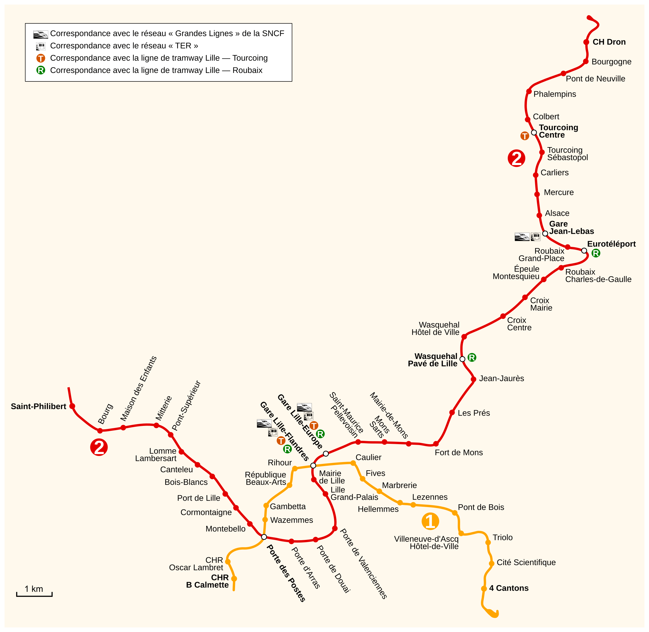
Photo credits (CC BY-SA 3.0) : Sardon

A large map of the Lille metro in northern France. A detailed map of the Lille metro, showing both lines and the names of all stations and connections.
The history of the Lille Metro began in the 1970s when local authorities sought an innovative solution to improve transportation across the growing metropolitan area. Construction started in 1978 using the revolutionary VAL (Véhicule Automatique Léger) technology, the world's first fully automated light metro system. Line 1 opened in 1983, connecting Lille with nearby suburbs, followed by Line 2 in 1989, which was gradually extended over the following years. The success of the automated system inspired similar metro networks in several cities around the world. Today, the Lille Metro consists of two fully automated lines serving dozens of stations across Lille, Roubaix, Tourcoing, and neighboring communities, remaining a key element of public transportation in northern France.