Metro map of Kuala Lumpur
Detailed map of the Kuala Lumpur metro system in Malaysia
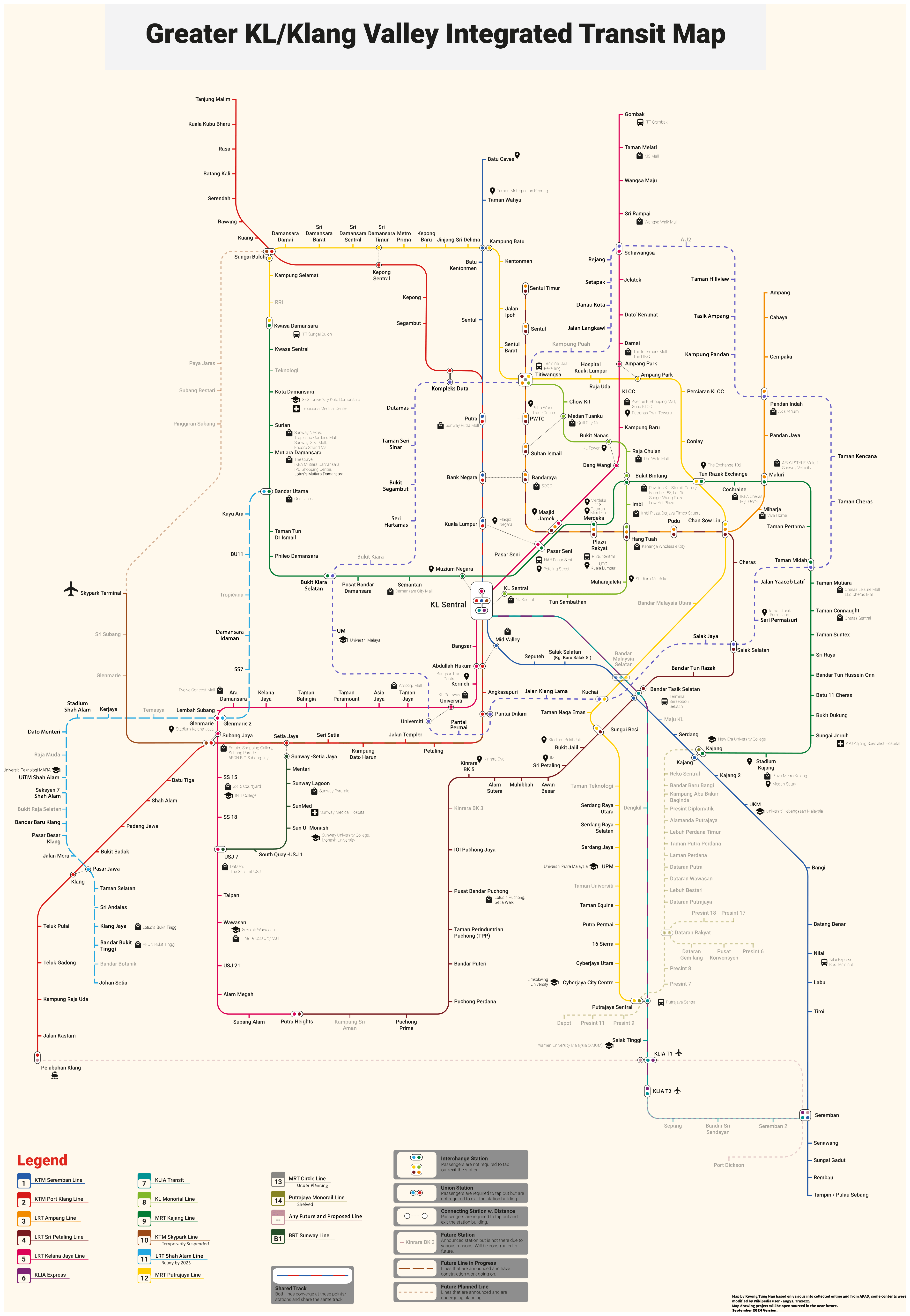
Photo credits (CC BY-SA 4.0) : Kwong Tung Nan
.svg)
A large, detailed map of the Kuala Lumpur metro system in Malaysia. A map of the Kuala Lumpur metro system with all lines and station names. The map includes metro lines under construction and planned lines.
The history of the Kuala Lumpur Metro began in the 1990s with the development of modern urban rail systems to address the city's rapid growth and increasing traffic congestion. The first rapid transit services were introduced through the LRT network in 1996, followed by the KL Monorail in 2003. Construction of the city's first MRT line started in 2011, and the Sungai Buloh–Kajang Line opened in 2017, marking a new era for public transportation in Malaysia's capital. Since then, additional MRT lines have expanded the network, improving connections between residential suburbs, business districts, and major transport hubs. Today, Kuala Lumpur's integrated rail system is one of Southeast Asia's largest and continues to grow to meet the needs of the metropolitan population.