Metro map of Kharkiv
Detailed map of Kharkiv metro in Ukraine
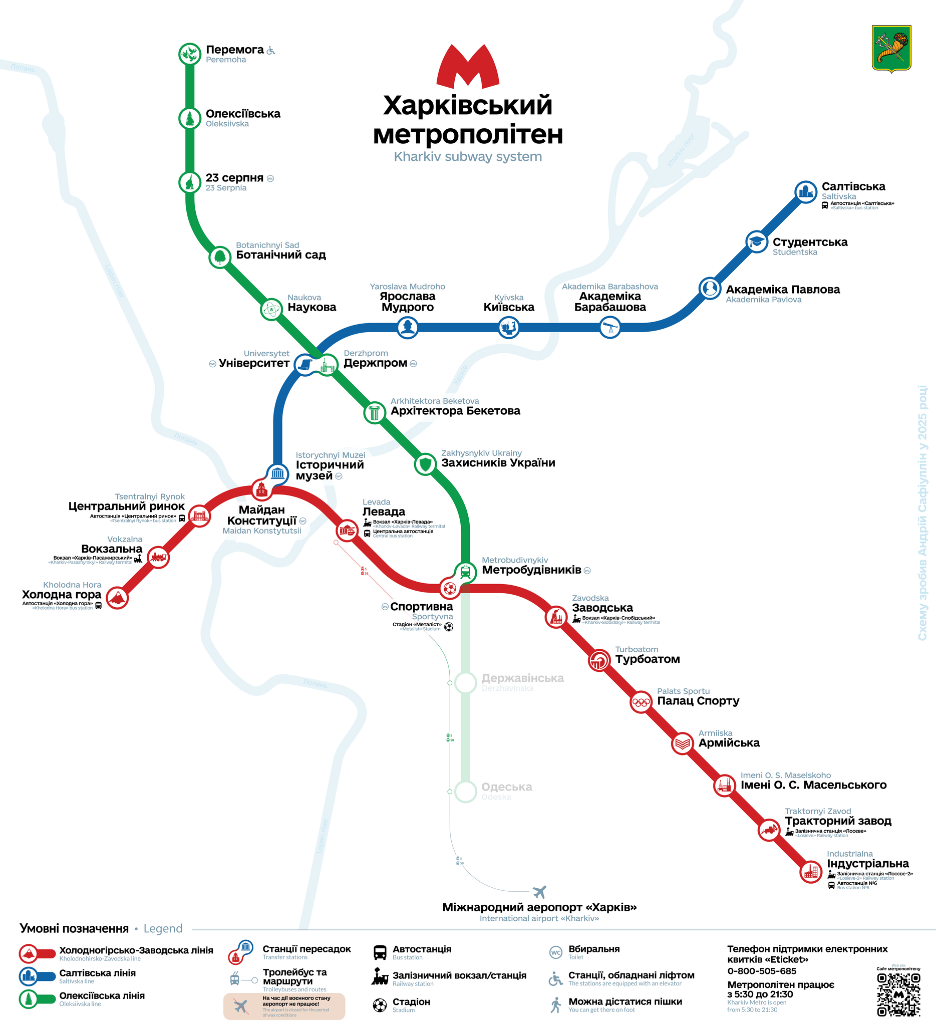
Photo credits (CC0 1.0 Universal) : Сафиуллин Андрей Айратович

A large, detailed map of the Kharkiv metro in Ukraine. The metro map shows all lines and station names in both Ukrainian and English.
The history of the Kharkiv Metro began in the 1960s as the Soviet Union sought to improve public transportation in one of its largest industrial cities. Construction started in 1968, and the first line opened in 1975, linking major residential districts with the city center and industrial areas. Over the following decades, the network expanded with additional lines and stations, becoming an essential part of daily transportation. The metro has also served as an important underground shelter during periods of conflict, highlighting its significance beyond public transit. Today, the Kharkiv Metro consists of three lines and remains a vital transportation system despite the challenges posed by the ongoing war and continued efforts to maintain operations.