Metro map of Hamburg
Detailed map of the Hamburg metro in Germany.
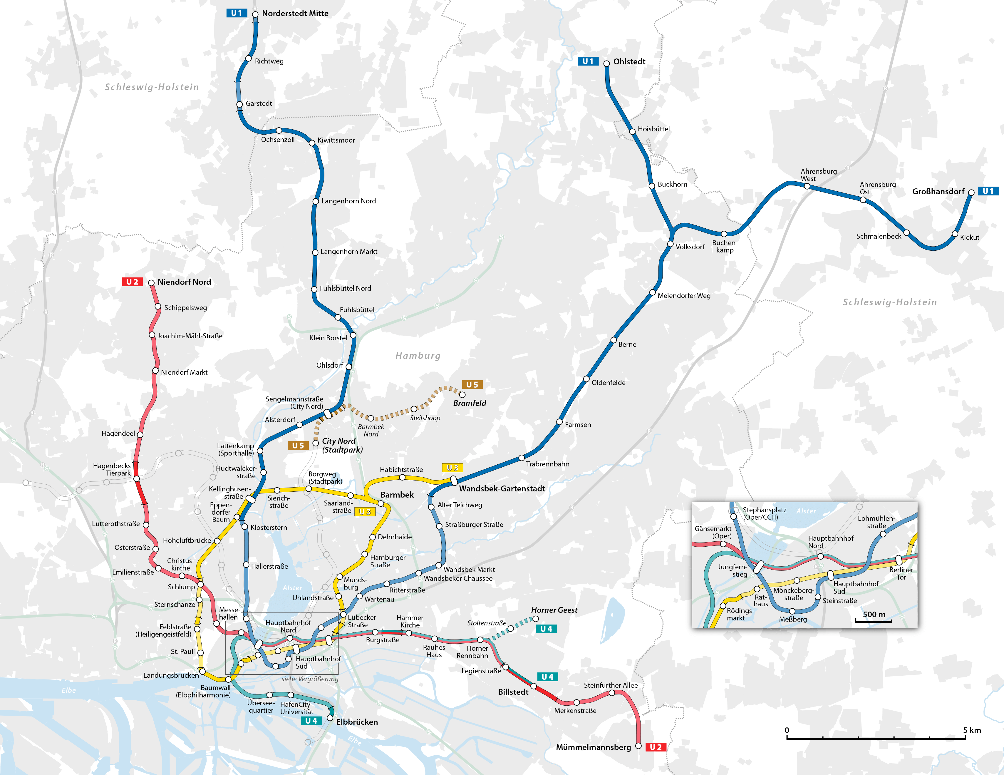
Photo credits (CC BY-SA 3.0 DE) : NordNordWest

A large map of the Hamburg metro system in Germany. A detailed map of the Hamburg U-Bahn metro system with station names and metro lines.
The history of the Hamburg U-Bahn began in 1906 when construction started on the city's first underground railway. The initial line opened in 1912, making Hamburg one of Germany's earliest cities to operate a rapid transit system. Unlike many metro networks, large sections were built on elevated viaducts, giving the railway its distinctive appearance. During the following decades, the network expanded steadily to connect growing residential districts, commercial centers, and industrial areas. Extensions continued after World War II, despite significant wartime damage to parts of the system. Today, the Hamburg U-Bahn consists of four lines serving more than 90 stations. Modernization projects, accessibility improvements, and the construction of the new U5 line are ensuring that the network continues to evolve as a key part of public transportation in northern Germany.