MAPSUBWAY
Metro map of Guadalajara
A large map of the Guadalajara metro in Mexico
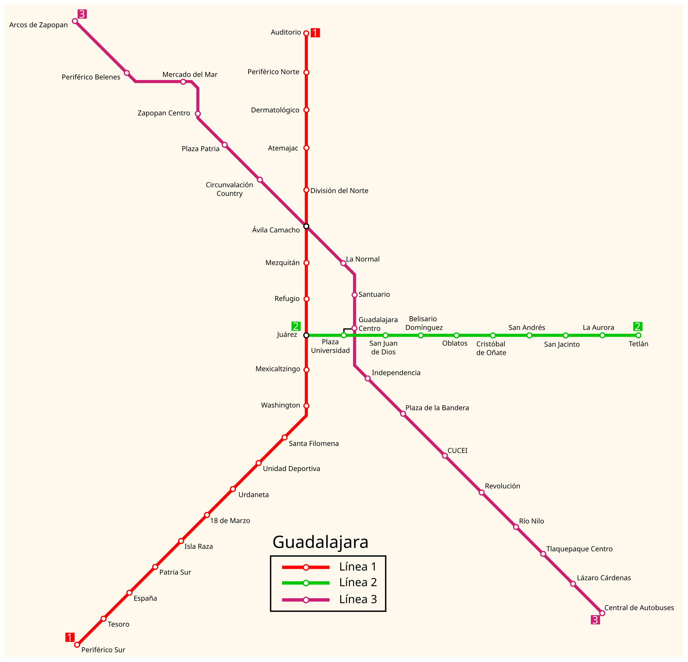
Photo credits (CC BY-SA 4.0) : ManuelContreras1996

A large, detailed map of the Guadalajara metro in Mexico with the city's metro lines and station names.
The Guadalajara Light Rail system opened on 1 September 1989, providing the city with its first modern rapid transit line. Since then, the network has expanded to connect major residential neighborhoods, business districts and important transportation hubs across the metropolitan area. Today, it is one of Mexico's busiest urban rail systems, serving hundreds of thousands of passengers every day.