MAPSUBWAY
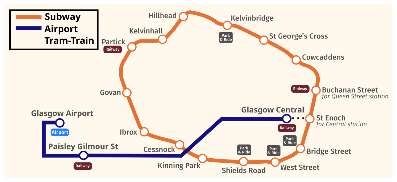
Metro map of Glasgow
A detailed map of the Glasgow Underground in the UK

Photo credits (CC BY-SA 2.0 CA) : DavidArthur, RaviC
A large map of the Glasgow Metro system in the UK. A map of the Glasgow Metro's circular line, showing the names of the 15 stations, as well as the proposed construction of the train line (in blue) that would connect the airport to the central station.