MAPSUBWAY
Map of the Budapest metro
Detailed map of the Budapest metro in Hungary
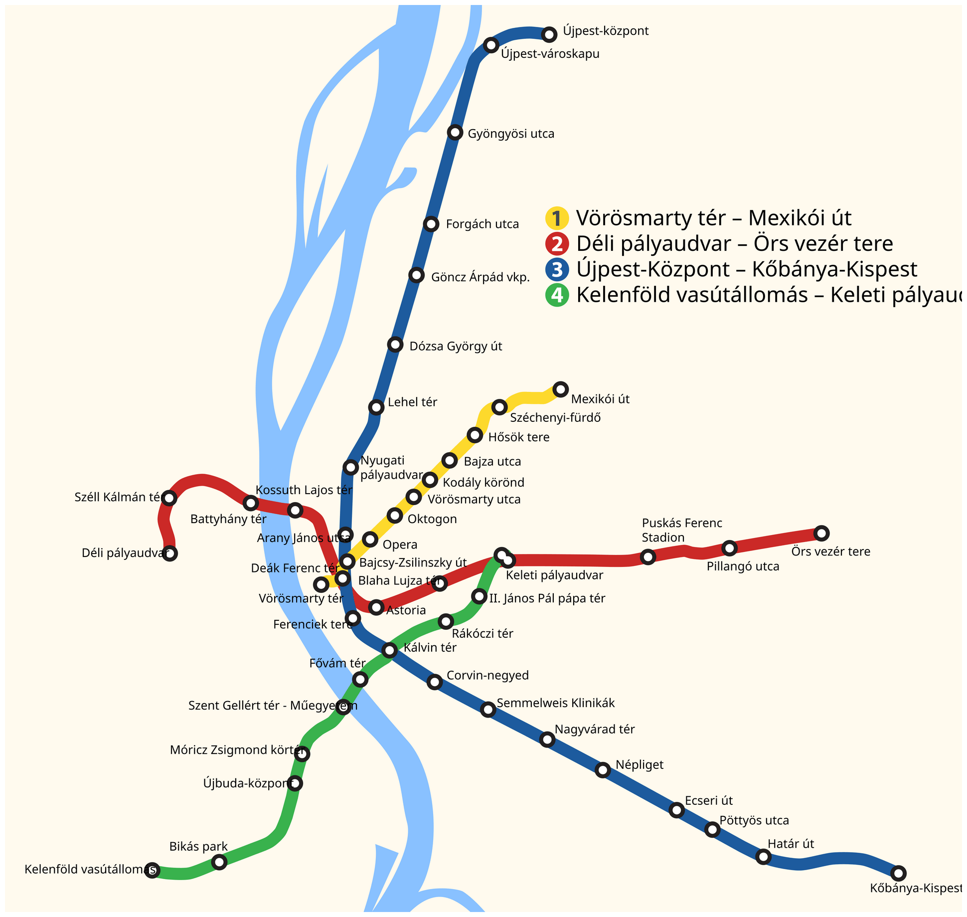
Photo credits (CC BY-SA 4.0) : Vampeare

A large, detailed map of Budapest, the capital of Hungary. The map shows the city's four metro lines with station names in Hungarian.
The history of the Budapest Metro began in 1896 with the opening of Line M1, built to celebrate the 1,000th anniversary of Hungary. It was the first electric underground railway in continental Europe and remains one of the oldest metro systems in the world still in operation. After decades of slow expansion, Line M2 opened in 1970, followed by Line M3 in 1976. The fully automated Line M4 entered service in 2014, bringing the network to four lines. Today, the Budapest Metro is an essential part of the city's public transport system, combining historic heritage with modern infrastructure.