Metro map of Amsterdam
Large detailed map of the metro in Amsterdam in Netherlands
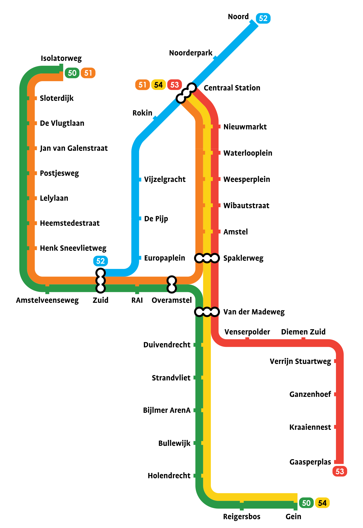
Photo credits (CC BY-SA 3.0) : Alargule
.svg)
Large map of the Amsterdam metro in the Netherlands with all lines and stations.
The Amsterdam Metro is the rapid transit system serving the Dutch capital and its surrounding municipalities. Planning for the network began in the 1960s as the city sought to modernise its public transport system, and construction started in 1970. The first metro line officially opened on 14 October 1977, connecting Weesperplein with Amsterdam Bijlmer (now Amsterdam Bijlmer ArenA). Since then, the network has expanded steadily, with new routes and extensions improving connections across the metropolitan area. A major milestone came in 2018 with the opening of the North–South Line (Metro Line 52), linking Amsterdam Noord with Amsterdam Zuid through tunnels beneath the historic city centre. Today, the Amsterdam Metro consists of five lines covering more than 42 kilometres and serving 39 stations. Operated by GVB, the system plays a vital role in the city's public transport network, complementing Amsterdam's famous trams, buses, ferries, and extensive cycling infrastructure.